
The Agulhas Current flows along the eastern shores of South Africa. It is one of the most powerful currents in the world, with velocities in the current often reaching 4 knots. By comparison, maximum current velocities in the Benguela Jet are about 1 knot. Because of its width and depth, the Agulhas Current – like the Gulf Stream – is a major driver of the global and regional climate.
Understanding how the Agulhas Current varies is hugely important for other reasons too. Its interactions with coastal and shelf waters as a result of slight changes in its path or strength affect major economic activities like fishing, oil and mineral exploration and ship routing. For example, interactions between the current flow and a large swell from the Southern Ocean can lead to rogue waves, a major hazard for ships.
Changes in ocean circulation and water properties also have a direct impact on marine environments’ productivity, the availability of food for fish species and how and where fish move. South Africa’s coasts and shelves are home to more than 2,200 sea fish species, many endemic fish and many exotic fish. But this marine richness is under increasing threat from humans, particularly along the densely populated east coast. A good knowledge of ocean current conditions along South Africa’s south eastern shores is therefore essential to adequately manage the rich marine ecosystems.
But how the powerful Agulhas Current influences coastal regions is still poorly understood. This is because ocean currents between the Agulhas Current and the coast change rapidly in time and space. This makes them very challenging to observe.
Observing the Agulhas Current
Oceanic features between the Agulhas Current and the coast can’t be properly observed using traditional observing platforms. These include satellites, single ship surveys or oceanographic moorings – instruments attached along a cable anchored to the sea floor.
For example, in the case of the Agulhas System Climate Array which was first deployed in 2015, each of the moorings in the array are about 25 km apart. So while the array is very useful for quantifying large scale and long-term changes in the Agulhas Current, it can’t observe the fine scale variations at the landward edge of the Agulhas Current which have a strong impact on the shelf and coast.
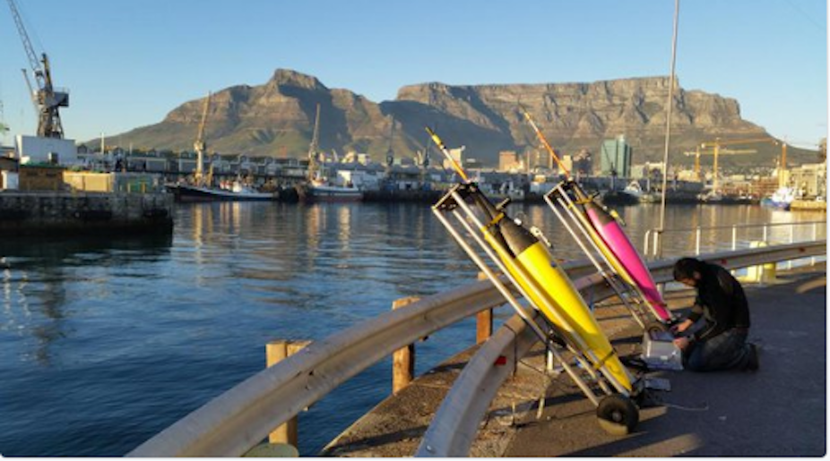
Gliders don’t have these limitations. These autonomous robotic platforms use two-way communications to relay data back to the shore in real time. Sensors on gliders measure things like pressure, temperature, salinity, ocean current and biological variables. They can provide continuous (multi-month) measurements at high spatial (100s of meters to kms) and temporal (0.5-4 hourly) resolution.
Gliders are cost-effective and easy to deploy. They are increasingly becoming integrated in global marine observing systems.
Putting the gliders to use
Gliders have been successfully used in the Southern Ocean region since 2012. But there has been no sustained programme established around the South African coastline.
There have been some baby steps. Two years ago the first ocean gliders were deployed in the Agulhas Current region. The project was a collaboration between the Council for Scientific and Industrial Research, South Africa’s central and premier scientific research and development organisation and the South African Environmental Observation Network.
These first glider observations showed how useful they can be.
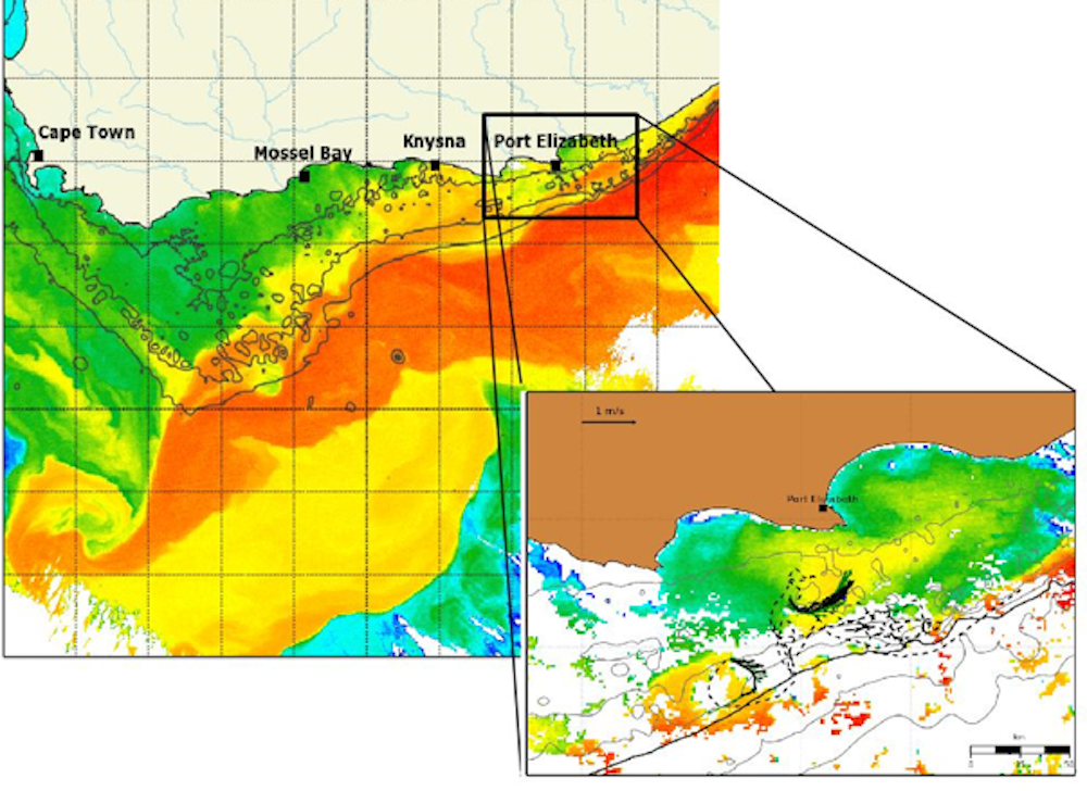
For example, the gliders observed changes in and near the Agulhas Current currents happening over distances of 1-10 km. Over a period of one month, observations collected from two gliders revealed the presence of small cyclonic (clockwise) eddies at the edge of the Agulhas Current closest to the coast. These ocean cyclones were triggered by interactions between the Agulhas Current and the sea-bed.
The knock-on effect of these small cyclones was to cause intermittent currents towards the north-east – that is, against the Agulhas Current flow. Counter currents like this could help fish species in the region migrate from the southern to northern Agulhas, like the sardine run when millions of sardines travel from the Agulhas Bank to the Natal Bight in Kwazulu Natal. This usually happens between May and July. During this period the young sardines may take advantage of similar periods of north-eastward flow to progress against the Agulhas Current.
More high resolution observations are needed to determine how often ocean features like these small cyclones occur and to improve our understanding of their impact on the marine ecosystem.
Ocean science research in South Africa has historically been divided between the large scale domains – ocean basin scales – and inshore coastal domains –bays and estuaries and within a few kilometres of the shores. An ocean glider network could provide the continuous and high resolution ocean observations which are needed to connect deep ocean variability to our coastal regions.