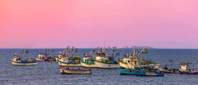


It was anchovy fishermen in Peru who first noticed and named El Niño events in the tropical Pacific hundreds of years ago. Their catches would fluctuate and the largest declines were seen near Christmas when the ocean was at its warmest – they called it El Niño de Navidad, the boy of Christmas.
With a larger network of observations and some inspired statistical analysis, it became apparent that this decline in fish stocks was part of a Pacific-wide phenomenon including changes in the ocean and atmosphere. This was ENSO, the El Niño-Southern Oscillation.
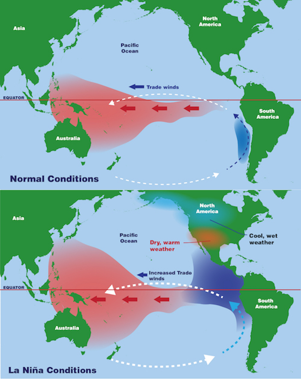
As part of this analysis it became clear that during El Niño events the Pacific was typically warmer than usual in the east, colder in the west, and the trade winds blowing from east to west were weaker. What also became clear was that there were other times when the winds were stronger and the east was colder and the west was warmer. These periods were named La Niña – the girl – in a nod to their opposite characteristics to El Niño.
El Niño or La Niña conditions typically last for around nine months, beginning in June, peaking in December, before dissipating by April. Historically, La Niña events have been smaller and less noted – the change in the anchovy catches is not as notable as the collapse seen in El Niños so was never remarkable to the Peruvian fishermen. However, for a number of reasons, La Niña is becoming a more noted phenomenon.
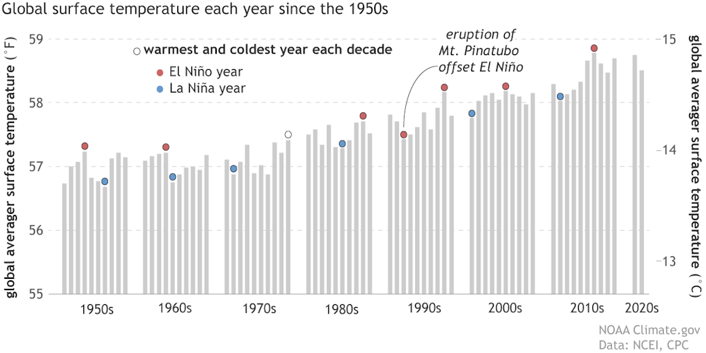
During La Niña events, global temperatures tend to be colder and this can explain some of the downward bumps on the otherwise inexorable rise of global temperatures. Last year, 2022, was the third consecutive La Niña year, which is highly unusual and has only occurred three times since reliable records began in the 1950s. Outside of the tropical Pacific, the effects of La Niña can be just as marked and just as devastating as those of El Niño, which is likely to return in late 2023.
How changes in the tropical Pacific affect the rest of the world
Climate scientists have been aware of how changes in the atmosphere in one location can be linked to another for many years. These links are termed “teleconnections”. Perhaps the first example of a teleconnection was described in the 1920s by the physicist Gilbert Walker who noticed that changes in atmospheric pressure in Darwin, on the north coast of Australia, and Tahiti, 8,000kms away in the middle of the Pacific, were linked through, what he termed, the Southern Oscillation. This observation ultimately led to the description of the El Niño/La Niña phenomenon.
Teleconnection patterns have now been noticed in all regions of the globe. In northern Europe the most well known is the North Atlantic Oscillation, which describes a link between air pressure in a particular area over Iceland and one over the central North Atlantic near to the Azores. Changes can then be linked to changes in the weather over northern Europe and the UK.
These teleconnection patterns exist because the global atmosphere behaves like a drum. If you hit a drum in one location the whole surface vibrates and the note that the drum sounds depends upon how tight the drum skin is.
In this analogy, heating in the tropical atmosphere plays the role of the drum stick and the waves that spread out across the surface are termed Rossby waves. The “note” that these waves play is determined by the structure of the atmosphere, but rather than skin tension it is the winds and rotation of the earth that determine the pitch of the atmosphere.
The strongest teleconnection from the tropical Pacific and La Niña is within the Pacific Basin. For example La Niña events tend to mean wetter winters in the Pacific Northwest of the US.
However, Rossby waves can reach all the way across North America and into the North Atlantic, where they can start to affect the weather by tweaking the high-altitude jet stream which can in turn affect the storms that are responsible for much of the UK’s winter rain.
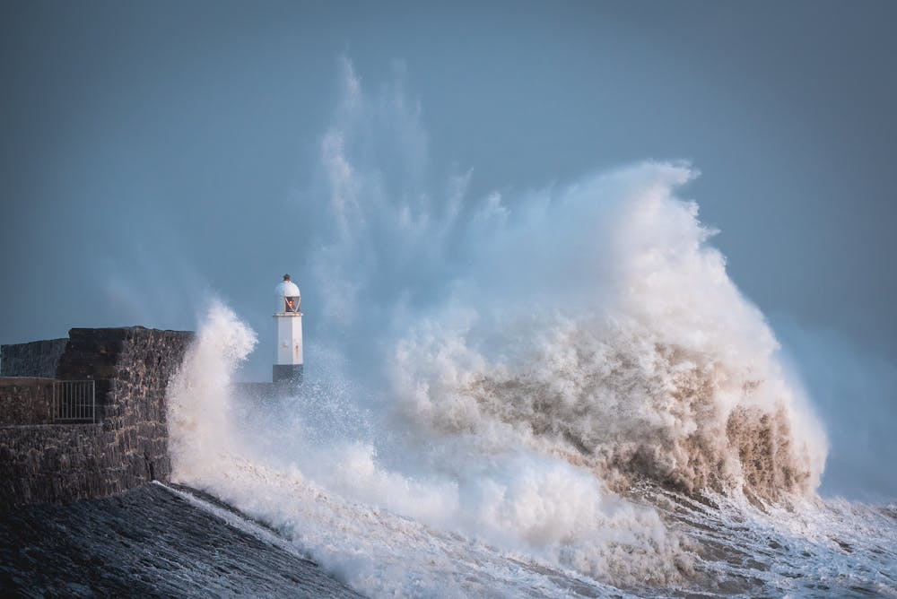
Because the behaviour of Rossby waves depends upon the winds in the atmosphere, La Niña’s influence on the North Atlantic is not the same in all seasons. In late winter the Rossby waves from La Niña tend to intensify and shift the Atlantic jet stream towards the North Pole, causing more storms to hit the UK and with them increase the rainfall.
It’s harder to directly link the two in early winter, since in this season the Rossby waves interact with winds that are more affected by the climate state of the tropical Atlantic.
An uncertain future
It’s hard to know exactly what climate change will mean for El Niños and La Niñas. Average sea surface temperature across the Pacific will increase, but that is less important to the generation of these weather patterns than the difference in surface temperature between west and east Pacific about which there is a lot less certainty (in part because the surface temperature in the eastern Pacific is always heavily influenced by the upwelling of deeper colder waters).
Computer programs that model the climate suggest the Pacific’s east-west temperature difference will diminish in future, favouring EL Niños which tends to mean more droughts in Australia and other severe weather across the Pacific and beyond. However, the past two decades of enhanced temperature differences and prolonged La Niña events suggest otherwise. The recent three-year La Niña is therefore very interesting, though it’s too soon to draw any firm conclusions.
Changes in the teleconnections are equally uncertain. Therefore, uncertain changes in the teleconnections on top of uncertain changes in La Niña and El Niño add up to an uncertain outlook for the future.

Don’t have time to read about climate change as much as you’d like?
Get a weekly roundup in your inbox instead. Every Wednesday, The Conversation’s environment editor writes Imagine, a short email that goes a little deeper into just one climate issue. Join the 10,000+ readers who’ve subscribed so far.