
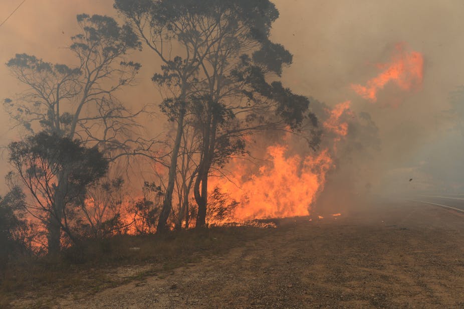
Even without the official tally it looks like the fires that started yesterday in Blue Mountains will be the most costly in terms of property since 1968. But how have they come about?
Why is the area vulnerable to bushfires?
The Sydney Basin is home to unique vegetation that comes from two factors. First, the soil is infertile. Second, the area sees relatively high rainfall. The result is a vegetation known as sclerophyll, which means “hard leaves”.
Seventy per cent of the Sydney Basin is dry sclerophyll forest. It’s characterised by open forest with a dense understory. It’s also incredibly diverse. There are over a hundred species of eucalypts in the region, which includes the Blue Mountains World Heritage Area.
The hard leaves on these plants don’t break down very rapidly, so they tend to accumulate as litter. The dense shrub layer also provides an ideal fuel bed for wind driven fires.
Bushfire fuel accumulates very quickly to a high level in these ecosystems, so the principal ingredient for fire, fuel is not lacking for very long. As a result, this part if the world is very fire prone. Our research based on historical analysis of fires in the area shows that any given point will experience a fire every 20 years on average. Some areas close to human developments experience fires more often than this.
Major human disasters with home losses - such as that in the Blue Mountains yesterday - have occurred every ten years on average for much of the twentieth and twenty first centuries.
The plants like these sort of fires; they’ve evolved to regenerate particularly well in response to them. We’ve done recent work which shows the rate of recovery of vegetation after fires is extremely fast. Typically within five years the leaf area of the ecosystem has recovered, which we’ve shown with satellite imagery. Maturation and replenishment of seed stores of some species may take longer - some up to decade after fire.
The system is well geared to these sorts of fires. In some ways it’s interdependent with a regular, decadal cycle of relatively intense fires.
What about the weather?
Typically in spring and early summer we see strong cold front activity, strong winds and warm air being brought down from the interior ahead of the cold front.
When you mix that together with the terrain - which is very steep and dissected - and the vegetation characteristics, you get the prerequisites for fast-runnning and relatively intense fires.
It’s also extremely dry at the moment. Dryness is an essential pre-requisite for fire, because it makes plant material available to burn. We know from recent research involving satellite monitoring that when you get very widespread dryness like this, the natural impediments to fire break down. In a complex, rugged landscape like the Greater Sydney region gullies and south-facing slopes form natural barriers to fires.
But now we’re in a situation where these barriers in the landscape are removed because it’s dry all over. These fires won’t go out soon, particularly the ones in remote area, unless we get heavy rain.
How do we manage fires in such a landscape?
New South Wales is divided into more than 50 bushfire districts and each district develops a bushfire risk management plan.
A typical bushfire management plan will consider human assets such as houses and infrastructure, the location of fire management infrastructure, historical patterns of ignition and fire travel - which are locally known. Ignitions tend not to be random, and we now have a good understanding of where ignition is likely to occur in areas such as the Sydney region.
The plan will then define a set of zones in the landscape to focus fuel reduction burns and mechanical removal to greatest effect, concentrated at depth (i.e. several kilometres) around development and infrastructure.
There are other areas of strategic importance where extensive fuel reduction will be carried out to slow fires and aid suppression.
We know through very recent research following the 2009 fires in Victoria that the area one kilometre around property is absolutely critical for defence. That’s where treating fuel to reduce fire and embers is particularly important. Houses need to be well set back from flammable bushland in order to survive fires in conditions similar to yesterday.
Unfortunately New South Wales and the greater Sydney Basin have been left with a legacy of development that continues to place property and infrastructure at risk. Although the development and planning regime has vastly improved in the past ten years, there’s still a huge stock of houses in very high risk areas. Risk management planning tries to account for that.
What about national parks and reserves?
National parks and reserves are managed intensely for fire. All public land-holders contribute to the risk management planning process. The strategy sits across all tenures in a district.
Within national parks and water catchments of the Sydney region there’s now a very sophisticated remote area fire capacity, based on helicopters. The idea is to try and get onto remote area fires soon after they start, particularly lightning fires. That’s proven to be a very cost-effective strategy.
How did yesterday’s fires start?
The fires yesterday didn’t start in remote areas and move into developed areas; rather they’re actually fires that started in developed areas. For example the fire at Springwood seems to have started close to property, and similarly the fire at Lithgow.
These fires are a combination of natural and human factors. Without pre-empting the authorities, its likely that some of them are human-caused (directly or indirectly) rather than originating from lightning.
We know from spatial mapping of ignition patterns over the past few decades that most fires start close to human development or human transport corridors in the Sydney region. The way people live in the landscape now is influencing the fire regime, and that pattern is overlaid on additional natural ignitions from lightning.
If you took humans out of the landscape you’d have a very different fire regime. Before European arrival there was probably a different fire regime again, a complex interaction between human activity and lightning. The Sydney fires are a consequence of people living in a highly fire-prone landscape.