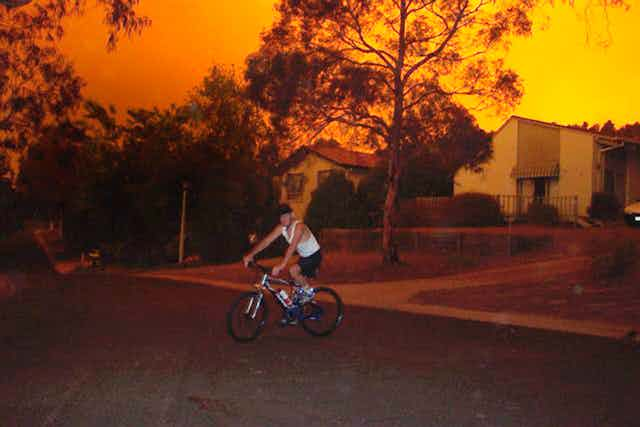
We’ve all seen footage of out-of-control bushfires sweeping the Australian landscape, burning out hectares of native forest in their wake. But you might not have heard of a fire tornado, let alone seen one.
For many years now researchers have theorised that fire tornadoes could be possible. Now, in studying the 2003 Canberra bushfires, our colleagues and us have shown fire tornadoes do indeed exist.
So what are fire tornadoes? Where do they come from? And what sort of damage can they cause?
Fire thunderstorms
To answer these questions, we first need to understand a separate – but related – phenomenon: fire thunderstorms, also known as pyro-cumulonimbus clouds.
The fires that form these clouds are often burning such large tracts of land that full thunderstorms can form within their plumes.
Lightning from these storms often starts new fires, seen spectacularly in the January 2006 fire in the Grampians, Victoria.

Such clouds can also create black hail – a manifestation of the unusual cloud physics and massive quantities of entrained smoke. This phenomenon was reported in the 2003 Canberra bushfires.
But that’s not all – our research has now shown that pyro-cumulonimbus clouds (pyroCb) can also produce tornadoes.
In a spin
Sometimes firefighters report seeing intense fire whirls – spinning columns of fire – and these are often erroneously called fire tornadoes. But these whirls are directly linked to the ground and to the heat generated by the fire – they are not true fire tornadoes.
A fire tornado is attached to the base of a pyroCb and, like a true tornado, it is a product of instability, moisture and wind shear. The low pressure core of a tornado is famous for picking up objects or water (as in a water spout).
But we’ve now confirmed it can also draw in flames if over a fire front, glowing more than a kilometre into the air.

The 2003 Canberra fire tornado
Unlike the fire whirls observed by firefighters, the 2003 Canberra fire tornado was linked to the base of a thunderstorm, lifted off the ground, and then touched down again, three times.
What made this fire different to other fires was the wide range of observations being made as the edge of Australia’s capital was threatened.
They included:
- airborne systems that featured a multispectral linescanner, which works like an earth-observation satellite, collecting data in multiple visible and infrared bands
- space-based imagery from six satellites
- weather radar and photographs
- videos from journalists, the public, and air observers, including the remarkable footage taken by Richard Moran for WIN News from the fire brigade commander’s vehicle (see video below).
We, in collaboration with our colleagues, then used these observations to determine the existence of the fire tornado.
Tracing the tornado
We showed that the weather conditions the fires were burning in were also suitable for tornado formation. We mapped the damage path, from the air and on the ground and could track the tornado in weather radar data.
We placed the contents of photographs in the correct place and time. Ultimately we were able to measure a number of the tornado’s physical properties.
The tornado’s movement over ground was determined from detailed damage mapping and photographic triangulation. Its horizontal and vertical wind speeds were similarly measured and estimated from damage types, using the Enhanced Fujita Tornado Damage scale.
It is now clear that some houses on Canberra’s edge were destroyed by this tornado. Others were damaged by both wind and fire.
So, on top of the already-present risk of bushfires, we now know that residents of Canberra (and elsewhere) face the risk of a tornado bearing down on their home if a fire is particularly fierce.
This indicates that we need to see if the Building Code of Australia might be able to consider tornadic wind loadings in structural designs for bushfire-prone areas.
And, with the bushfire season already upon us, what better time to get such discussions underway.
Craig Minns
Self-employed
Beautiful science, expertly explained, well done.
A couple of questions, if I may. Firstly, how common are these events? Presumably they are scale-dependent, so how large does a fire have to be to create the risk of pyroCb clouds and tornadic winds?
Second, what is the impact of the terrain in which the fire is located? Are fires on flat land as prone to such effects as those on hilly ground? I understand that hill fires are often more intense due to pre-heating of vegetation higher up slopes resulting in very rapid and broad ignition and hence faster propagation. Does this drive a higher chance of the catastrophic effects described?
It seems to me that such questions are relevant to the discussion around building codes, just as wind-ratings are varied according to location.
Thanks for a really interesting article.
Rick McRae
Researcher at ACT Emergency Services Agency
The frequency of pyro-cumulonimbus (pyroCb) events is a on-going research topic. Countries like Australia have only started being impacted by them in the last decade, based on global satellite monitoring of aerosols over more than three decades. Since 2001 we now have had dozens of them here. Other countries, such as Russia in 2010, have also started seeing them. Having only one confirmed pyro-tornadogenesis event does not permit any estimates of the frequency with which pyroCbs spawn pyro-tornadoes…
Read moreCraig Minns
Self-employed
Thanks for the explanation Rick. Why are these recent events? Is it down to vegetation management practises leaving large fuel loads in the field? If so, surely it should be a reasonably simple exercise to modify such practises to minimise the problem. Given that such events occur, if those management practises are contributory, then there arises an implication of culpability on the behalf of the agencies responsible. Is the science sufficiently well-established to draw that inference? If so, then the various bodies responsible have some significant soul-searching to do, it seems to me. If not, then what is the causative mechanism driving this relatively recent phenomenon?
Rick McRae
Researcher at ACT Emergency Services Agency
Craig asks an intersting question in this thread regarding the role of vegetation (fuel load) management in these events. In bushfire behaviour modelling we are accustomed to being able to see trends in fire behaviour as fuel load varies. However we have seen pyroCbs in a wide range of vegetation types: Ash forests, dry ironbark woodlands, deserts, Rocky Mountains conifer forests, boreal forests and even the Russian peat forests. If you want a predictive model for a pyroCb you need to account for how this range of vegetation structures and fuel loads can produce equivalent plume dynamics.
I'm not saying yes or no to the question, but I am saying that we need to do more research and approach it with an open mind. Remember that "traditional" bushfire behaviour modelling does not include atmsopheric stability, nor does it include the fire channelling process.
Andrew Glikson
logged in via email @iinet.net.au
Perhaps the authors can provide further explanation for the origin of a fire tornado, as follows:
1. Experiments producing an artificial fire tornado, starting from the ground, produce an upward-rising whirling fire plume (http://news.discovery.com/videos/earth-fire-tornadoes-explained.html).
2. However, the definition of "tornado" implies a downward-whirling "condensation funnel, whose narrow end touches the earth and is often encircled by a cloud of debris and dust" (http://en.wikipedia.org…
Read moreRick McRae
Researcher at ACT Emergency Services Agency
Happy to try to clarify...
Read moreWe are aware of a number of bodies of evidence regarding fire whirls involved with fire. They are quite spectacular and may be very damaging in extreme instances. However the total body of evidence in the Canberra case from 2003 is unequivocal in demonstrating that tornadogenesis occurred. Much of this is beyond what may be placed in an article for a science journal.
We have been involved in a series of studies of pyro-cumulonimbus events, as part of global collaboration…
John Holmes
Agronomist - semi retired consultant
When does an intense fire whirl become a tornado?
Spectacular events were not uncommon during the clearing burns when we were clearing the home farm during the & 60's in WA. Only about million acres in WA / year.
Read moreIn late summer/early autumn we would carefully light up the areas which had been rolled or bulldozed 6-8 months previously. Most of our area was dense mallee with some wandoo and patches of mort's which had quite large fuel loads. The fires were started on the downwind side of…
Comment removed by moderator.