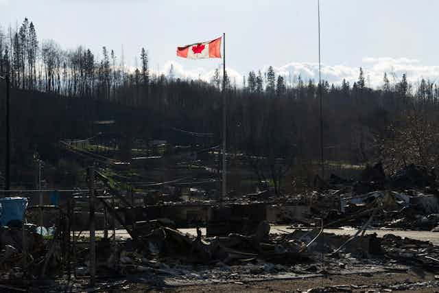

As many as 90,000 people were evacuated from the Canadian town of Fort McMurray and its surrounds, after a massive wildfire endangered the lives and homes of residents. It is thought that 2,400 buildings have been destroyed by the flames, while between 80% and 90% of the town has been saved. Gas and power have been cut, and the water is currently undrinkable.
In fact, the outcome could have been much worse. If it weren’t for the efforts of firefighters, the entire downtown area of Fort McMurray could have been destroyed. What’s more, there have been no fatalities as a direct result of the blaze – although it is reported that two people lost their lives in a car accident, while fleeing the city.
Learning the lessons
It seems like other cities could learn a thing or two from the events in Fort McMurray. Whether the threat comes from a fire or a flood, a few basic principles can be applied to ensure that residents are safely evacuated. For instance, it’s crucial to have a plan for evacuation in advance, to warn people in the affected areas ahead of time and to coordinate the response of emergency services, residents and local authorities.
The most serious consideration when planning an evacuation is to be able to identify which evacuation paths are available, and how these paths could change as the threat develops. Organised, city-wide evacuation is only used in very rare circumstances – instead, most evacuations are initiated by individuals or households. This makes it especially important for residents to have access to up-to-date information about the range of the disaster, the location of safe zones and official advice.
New technology has the potential to play a significant role in all of this – especially in areas where emergency services aren’t as well resourced or organised. There is a demand for tools to help with the planning and management of evacuations, especially at a household level, which digital technology can fulfil. In particular, smartphone apps and Internet of Things technologies provide ideal platforms for these purposes.
The way forward
One tool called “FLOODsite” – which focuses on evacuation modelling and traffic management during floods – was tried in three sites recently: the Thames Estuary in the UK, the Schelde Estuary in the Netherlands, and the Gard Region in France. And at Loughborough University’s Emergency Management group, we have been exploring past experiences of natural disasters, to develop our own real-time evacuation planning tool, which can be updated as the threat spreads.
We considered the damage inflicted on parts of the UK and the Netherlands, due to storm surges in 1953 and 2013. During the January 1953 event, 307 lives were lost in the UK, and 1,800 in the Netherlands. Over 32,000 people were evacuated and most of the infrastructure, including power stations, railways, sewage services and water services were damaged. Physical damage in the UK at the time was estimated to be approximately £50m.

By contrast, in December 2013, thousands were evacuated in the same region, when another tidal surge reached higher levels than the 1953 event, and only two casualties were reported in the UK, one in Sweden and one in Denmark. This time, early warning and planned evacuation took place. For example, in eastern England about 10,000 homes were evacuated in Norfolk and Suffolk. We found that the inability to warn people in time was one of the main reasons for the heavy casualties in the earlier surge.
Using storm surges from recent years – including the 2013 event – as case studies, we developed a tool which can identify designated assembly points in the affected region, and find the user the shortest path from each assembly point to the safe areas for evacuees.
In collaboration with regional partners and the UK’s National Environment Agency, we are now extending our work to other areas near the North Sea. For instance, the city of Kampen, in the Netherlands, runs a flood defence exercise every year. We were lucky enough to witness members of the “high water brigade” – a well-organised voluntary team under the supervision of the city’s emergency services – build a temporary wall to protect the city in case of high water levels.
They also successfully demonstrated how authorities can communicate with local residents about the threat, via text message and voice alert. A live map with geo-tagged photos and text shared by volunteers was also created during the exercise, allowing the coordinators an overview of the situation on the ground. We hope that these new technological developments will enhance cities’ ability to respond to disasters, and increase the resilience of affected communities.
The risks posed by natural disasters – whether wind, fire or flood – aren’t going away; in fact, they may get more serious, along with climate change. That’s why it’s so important that we develop new ways to respond quickly and efficiently to unexpected events. With it’s capacity for instant updates and location-based guidance, personalised technology is truly the way forward for disaster management.