The 2012 northern hemisphere summer, like its two predecessors, has seen a wide range of climate extremes, many involving heat. In most recent summers there has been at least one part of the world with an “off the scale” heatwave, far beyond previous records: it was 2003 in central Europe and 2010 in Russia, while Australia had a sequence of extreme heatwaves in 2009.
In 2012, the United States has been a particular focus. But many other areas have also felt the impact of an abnormally hot summer. More than three-quarters of land areas north of the Tropic of Cancer had average summer temperatures at least 1°C above normal. Temperatures 2 to 4°C above normal were widespread through large parts of North America, and in a band stretching from the Balkans through southern European Russia into western and central Siberia.
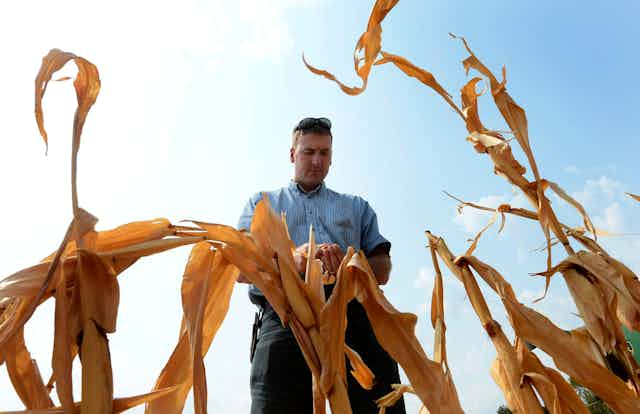
Heat and drought have been a regular theme in the United States in recent months. The intense but relatively localised drought which affected Texas and northern Mexico in 2011 spread to cover large parts of the continental US in 2012. Only the west and east coasts remained largely unaffected. Moderate to exceptional drought now covers 63% of the continental US; the only other droughts of comparable or greater extent in the last 100 years were in the mid-1950s and the “Dust Bowl” years of the 1930s.

The most intense drought is in the heart of America’s main wheat-growing areas, including most of Nebraska, Kansas and parts of Oklahoma and Missouri. Rains from the remnants of Hurricane Isaac in late August improved the situation somewhat in Arkansas and Missouri, but were more than offset by deteriorating conditions further north.
The effects of the drought and heat on agriculture have been substantial. The final impacts on crop yields will not be known until harvest, but it is already clear that losses will be many billions of dollars.
American temperatures have also been well above average since early 2012. Nationally averaged temperatures for 2012, to date, are running over 2°C above normal and more than half a degree ahead of previous records. This is a margin so large that even normal conditions for the rest of the year will be enough to give the US its hottest year on record. July 2012 was the US’s hottest month on record. A moderation in temperatures during August dropped the summer’s national ranking to third, but it remained the hottest summer on record for some inland areas, including Colorado and Wyoming.
Southern Europe, and most of the western half of Europe, also had a hot and rather dry summer. Russian temperatures, while not as extreme as those of the summer 2010, were still well above normal. Crop yields suffered despite intermittent rain. The summer ranked amongst the three hottest on record in many parts of southern Europe.

The most significant heatwave took place in the third week of August, including national record high temperatures for the Czech Republic, Moldova and Montenegro. In Prague it reached 39.6°C, nearly two degrees above the previous record in more than 200 years of observations. In contrast, the northwestern fringe of Europe had a wet summer with near-normal temperatures. The United Kingdom had their second-wettest summer on record, abruptly marking an end to drought conditions which had affected central and southern England over the preceding year, and worrying Olympics organisers.
Another indicator of warm northern hemisphere conditions has been a new record low in Arctic sea ice extent. This dropped below the previous record low of 4.17 million square kilometres, set in 2007, in late August. It has now fallen well below 4 million square kilometres. There has also been extensive surface melting on the Greenland ice sheet, and on the higher peaks of the Alps in Europe, where some peaks are snow-free for the first time on record.
In the tropics and subtropics, the Indian monsoon season, which normally runs from June to early October, was late in getting under way. Rainfall up until the end of July was well below normal, especially in the western half of India. Conditions have improved since early August and rainfall for the season to date is now only 9% below normal.

In contrast, the often drought-plagued Sahel region of Africa, on the southern fringe of the Sahara, has had generally above-normal rainfall. It is on track to have its most productive wet season, rainfall-wise, since the 1970s.
Global tropical cyclone activity has returned to more normal levels in 2012 after two below-average years in 2010 and 2011. The focus of activities has been the western North Pacific. No typhoon has yet reached the highest category of intensity in terms of winds, but several have been responsible for major flooding. The northern Philippines were especially hard hit in early August, when Manila received 852 millimetres of rain in three days. North Korea has also been badly affected.
Global temperatures for 2012 continue to be much warmer than the long-term average, though 2011’s La Niña had a cooling effect early in the year which makes it unlikely 2012 will approach 2010’s record high. This year is currently running 0.41°C above the 1961-1990 average and is on course to rank somewhere between 6th and 10th warmest year on record. However, with the Pacific currently approaching El Niño conditions, the potential for 2013 to approach or even set a new record high global temperature is high.

