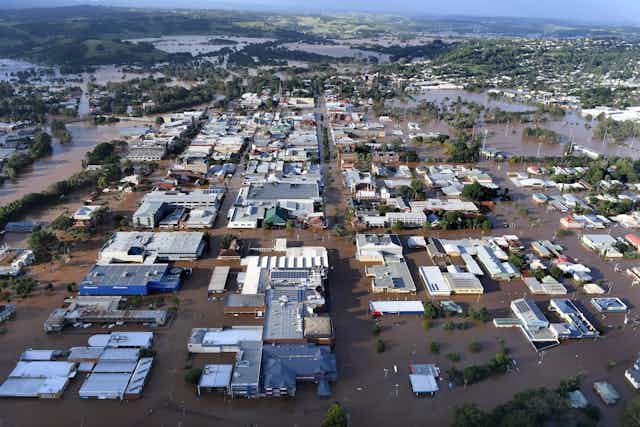

The devastating flood damage wreaked by Tropical Cyclone Debbie has left many residents in northern New South Wales facing an enormous cleanup that could take months.
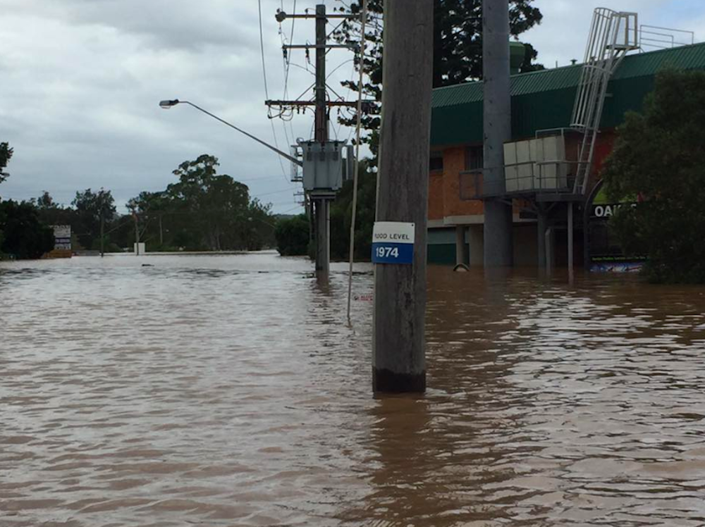
Any Lismore local will tell you that flooding is a fact of life in the Northern Rivers. In the floods of 1954 and 1974, the Wilsons River rose to a record 12.17 metres. This time around, the river peaked at 11.59m, breaching the flood levee built in 2005 for the first time.
So what are the conditions that caused those historic floods? And are they any different to the conditions of 2017?
Like the current flood, cyclonic rains also caused the 1954 and 1974 events. But unlike those past events, both of which were preceded by prolonged wet weather, almost all of the extreme rainfall from ex-Tropical Cyclone Debbie fell within 24 hours.
More interesting still is the fact that we are not currently experiencing La Niña conditions, which have historically formed the backdrop to severe flooding in eastern Australia.
The 1954 flood was preceded by an east coast low from February 9-11, followed by a decaying tropical cyclone from February 19-22. Thirty people were killed as flood records were set in Lismore, Kyogle, Casino, Nimbin and Murwillumbah. Some places received more than 1,000mm of rain in 14 days.
In 1974, former Tropical Cyclone Zoe unleashed torrential rain over Lismore, Wyrallah and Coraki. From March 10-13, some stations received almost 1,000mm in just four days. One analysis described the flood as a once-in-70-year event.
This time around, the remains of Tropical Cyclone Debbie delivered extreme rainfall to northern NSW towns including Murwillumbah, Chinderah and Lismore, despite having crossed the coast several days earlier and more than 1,200km to the north. Floods as far apart as Rockhampton in central Queensland and northern New Zealand show the storm’s colossal area of influence.
During the event, 20 rainfall stations in Queensland and 11 sites in NSW recorded their wettest March day on record. Mullumbimby, in the Brunswick River catchment, received a staggering 925mm during March – over half the annual average in a single month – causing major flooding in the region.
The heaviest rainfall in the Wilsons River catchment was at Terania Creek, which received 627mm over March 30-31, 99% of it in the 24 hours from 3am on March 30. Lismore recorded 324.8mm of rain in the 18 hours to 3am on March 31, its wettest March day in more than 100 years. A little further out of town, floodwaters submerged the gauge at Lismore Airport, so unfortunately we do not have reliable figures for that site.
The main difference between the current flooding and the 1954 and 1974 floods is that the previous events both occurred against a background of sustained La Niña conditions. These tend to deliver above-average tropical cyclone activity and high rainfall totals, which increase flood risk.
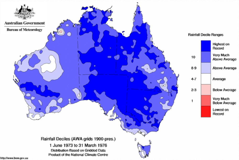
During the early 1970s, Australia experienced the longest period of La Niña conditions in the instrumental record. This unleashed phenomenal deluges across virtually the entire country. By the end of 1973, many catchments were already saturated as the wet season started early, culminating in the wettest January in Australia’s rainfall records.
In 1974 the Indian Ocean was also unusually warm (what meteorologists call a “negative Indian Ocean Dipole (IOD) phase”), further enhancing rainfall in the region. When negative IOD events coincide with La Niña conditions in the tropical Pacific, the warm sea temperatures reinforce one another, resulting in more evaporation and increased rainfall. This double whammy resulted in the exceptionally wet conditions experienced across the country during 1974.
In January 1974, the Northern Territory, Queensland and Australia as a whole recorded their wettest month on record, while South Australia and New South Wales recorded their second-wettest January on record. Torrential monsoon rains in the gulf country of Queensland transformed the normally dry interior into vast inland seas, flooding all the way to Lake Eyre in the arid zone of South Australia.
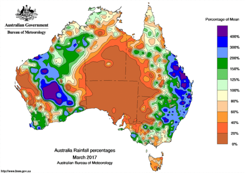
In contrast, Tropical Cyclone Debbie formed under neutral conditions, rather than during a La Niña. In fact, the Bureau of Meteorology is currently on El Niño watch, meaning that there is double the normal risk of an El Niño event bringing low rainfall and high temperatures to Australia by mid-2017.
So, unlike the 1950s and 1970s, the current flooding happened despite the absence of conditions that have driven major flooding in the past. It seems extraordinary that such a damaging cyclone could develop under these circumstances, and deliver such high rainfall over such a short time. This suggests that other factors may be at play.
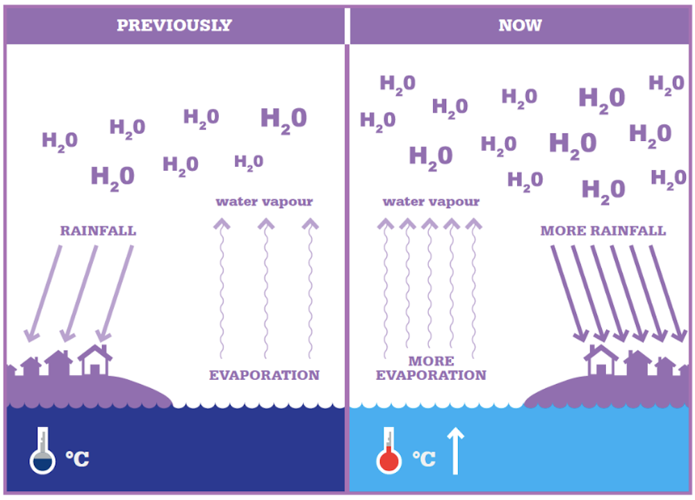
A rapidly warming climate means that storms are now occurring in a “super-charged” atmosphere. As temperatures increase, so does the water-holding capacity of the lower atmosphere. The oceans are also warming, especially at the surface, driving up evaporation rates. Global average surface temperature has already risen by about 1°C above pre-industrial levels, leading to an increase of 7% in the amount of water vapour in the atmosphere.
Of course, it is hard to determine the exact impact of climate change on individual storms. However, climate scientists are confident about the overall trends.
Australia’s land and oceans have warmed by 1°C since 1910, with much of this warming occurring since 1970. This influences the background conditions under which both extremes of the rainfall cycle will operate as the planet continues to warm. We have high confidence that the warming trend will increase the intensity of extreme rainfall experienced in eastern Australia, including southeast Queensland and northern NSW.
While it will take more time to determine the exact factors that led to the extreme flooding witnessed in March 2017, we cannot rule out the role of climate change as a possible contributing factor.
CSIRO’s latest climate change projections predict that in a hotter climate we will experience intense dry spells interspersed with periods of increasingly extreme rainfall over much of Australia. Tropical cyclones are projected to be less frequent but more intense on average.
That potentially means longer and more severe droughts, followed by deluges capable of washing away houses, roads and crops. Tropical Cyclone Debbie’s formation after the exceptionally hot summer of 2016-2017 may well be a perfect case in point, and an ominous sign of things to come.