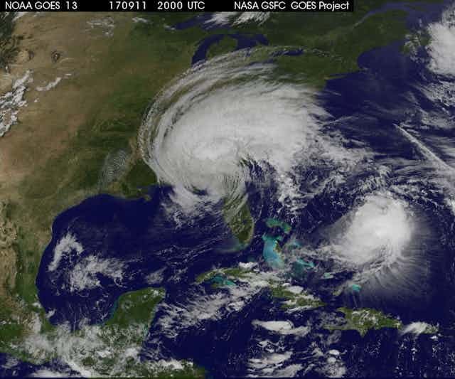


Hurricane Irma (now downgraded to a tropical storm) caused widespread devastation as it passed along the northern edge of the Caribbean island chain and then moved northwards through Florida. The storm’s long near-coastal track exposed a large number of people to its force.
At its peak, Hurricane Irma was one of the most intense ever observed in the North Atlantic. It stayed close to that peak for an unusually long period, maintaining almost 300km per hour winds for 37 hours.
Both of these factors were predicted a few days in advance by the forecasters of the US National Hurricane Center. These forecasts relied heavily on modern technology - a combination of computer models with satellite, aircraft and radar data.
Read more: Irma and Harvey: very different storms, but both affected by climate change
Forecasting is getting better
Although Irma was a very large and intense storm, and many communities were exposed to its force, our capacity to manage and deal with these extreme weather events has saved many lives.
There are many reasons for this, including significant construction improvements. But another important factor is much more accurate forecasts, with a longer lead time. When Tropical Cyclone Tracy devastated Darwin in 1974, the Bureau of Meteorology could only provide 12-hour forecasts of the storm’s track, giving residents little time to prepare.
These days, weather services provide three to five days’ advance warning of landfall, greatly improving our ability to prepare. What’s more, today’s longer-range forecasts are more accurate than the short-range forecasts of a few decades ago.
We have also become better at communicating the threat and the necessary actions, ensuring that an appropriate response is made.
The improvement in forecasting tropical cyclones (known as hurricanes in the North Atlantic region, and typhoons in the northwest Pacific) hasn’t just happened by good fortune. It represents the outcome of sustained investment over many years by many nations in weather satellites, faster computers, and the science needed to get the best out of these tools.
Tropical cyclone movement and intensity is affected by the surrounding weather systems, as well as by the ocean surface temperature. For instance, when winds vary significantly with height (called wind shear), the top of the storm attempts to move in a different direction from the bottom, and the storm can begin to tilt. This tilt makes the storm less symmetrical and usually weakens it. Irma experienced such conditions as it moved northwards from Cuba and onto Florida. But earlier, as it passed through the Caribbean, a low-shear environment and warm sea surface contributed to the high, sustained intensity.
In Irma’s case, forecasters used satellite, radar and aircraft reconnaissance data to monitor its position, intensity and size. The future track and intensity forecast relies heavily on computer model predictions from weather services around the world. But the forecasters don’t just use this computer data blindly – it is checked against, and synthesised with, the other data sources.
In Australia, government and industry investment in supercomputing and research is enabling the development of new tropical cyclone forecast systems that are more accurate. They provide earlier warning of tropical cyclone track and intensity, and even advance warning of their formation.
Still hard to predict destruction
Better forecasting helps us prepare for the different hazards presented by tropical cyclones.
The deadliest aspects of tropical cyclones are storm surges (when the sea rises and flows inland under the force of the wind and waves) and flooding from extreme rainfall, both of which pose a risk of drowning. Worldwide, all of the deadliest tropical cyclones on record featured several metres’ depth of storm surge, widespread freshwater flooding, or both.
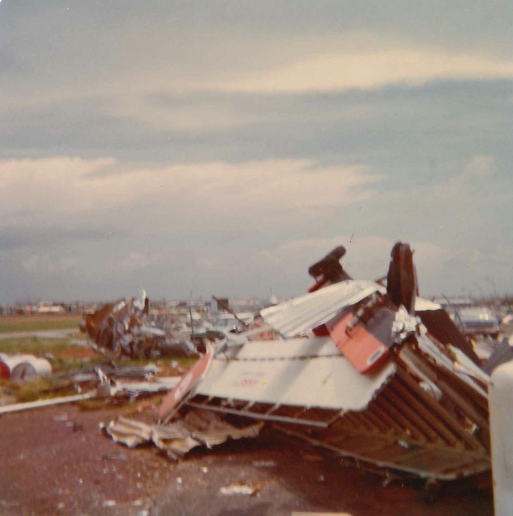
Wind can severely damage buildings, but experience shows that even if the roof is torn off, well-constructed buildings still provide enough shelter for their occupants to have an excellent chance of surviving without major injury.
By and large, it is the water that kills. A good rule of thumb is to shelter from the wind, but flee from the water.
This means that predicting the damage and loss caused by a tropical cyclone is hard, because it depends on both the severity of the storm and the vulnerability of the area it hits.
Hurricane Katrina in 2005 provides a good illustration. Katrina was a Category 3 storm when it made landfall over New Orleans, about as intense at landfall as Australian tropical cyclones Vance, Larry and Yasi. Yet Katrina caused at least 1,200 deaths and more than $US100 billion in damage, making it the third deadliest and by far the most expensive storm in US history. One reason was Katrina’s relatively large area, which produced a very large storm surge. But the other factor was the extraordinary vulnerability of New Orleans, with much of the city below normal sea level and protected by levées that were buried or destroyed by the storm surge, leading to extensive deep flooding.
We have already seen with Hurricane Irma that higher sea levels have exacerbated the sea surge. Whatever happens in the remainder of Irma’s path, it will already be remembered as a spectacularly intense storm, and for its very significant impacts in the Caribbean and Florida. One can only imagine how much worse those impacts would have been had the populations not been forewarned.
But increased population and infrastructure in coastal areas and the effects of climate change means we in the weather forecast business must continue to improve. Forewarned is forearmed.