


While eastern Australia trembles at the impending El Niño this year, potentially increasing heat waves and bushfires, the coastal waters of Western Australia (WA) would find El Niño a welcome relief from the heat.
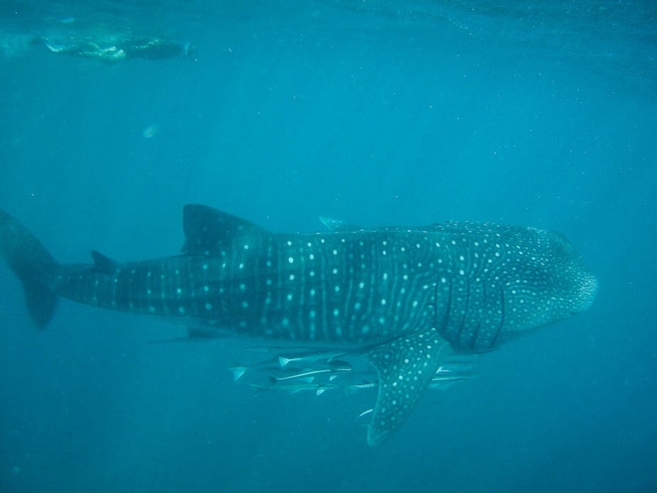
In the summer of 2010-11 WA’s oceans were struck by devastating marine heatwaves, with temperatures rising up to 5C above average, causing mass deaths of marine life and coral bleaching.
Temperatures have remained warm since, due to the lingering effects of the large 2010-11 La Niña. But El Niño could be the relief these waters need for marine life to recover.
Why is the water so warm?
The water temperature off the WA coast is determined largely by the Leeuwin Current, which flows south along the WA coast from Indonesia. The Leeuwin Current is unique in the world as it is the only subtropical poleward-flowing boundary current on the eastern side of an ocean basin.
Most coastal currents, such as the East Australian Current and the Gulf Stream, are found on the western side of ocean basins.
The Leeuwin Current occurs because of the “gap” between Australia and Indonesia that connects the Pacific and Indian Oceans. The easterly winds over the Pacific Ocean pile warm water up on the western side of the ocean basin. This increases the sea level through the Indonesian archipelago. The high sea level signal is then transferred down the coast of WA, creating pressure gradients that draw in warm water and push it southward, forming the Leeuwin Current.
The easterly winds over the Pacific Ocean vary over time, being stronger in La Niña years and weaker in El Niño. The changing wind strength alters the amount of water piled up in the west of the Pacific and hence the sea level near Indonesia: higher in La Niña years and lower in El Niño. The changing sea level then influences the strength of the Leeuwin Current.
La Niña drives marine heatwaves
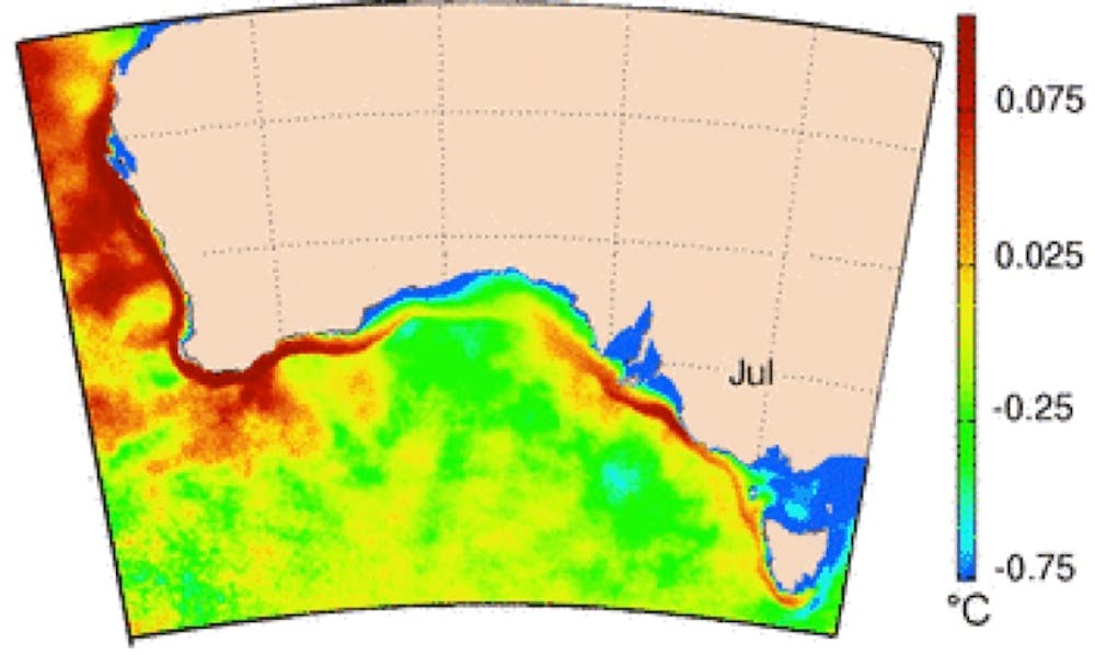
In a La Niña year, a stronger-than-normal Leeuwin Current forms off the northwest coast and flows southward, finally wrapping into the Great Australian Bight, extending to the west coast of Tasmania. The current also means warmer-than-normal water is transported further south along the WA coast, so temperatures are higher. In an El Niño year, the current weakens, and ocean temperatures fall.
La Niña drove the 2010-2011 marine heatwave (as well as the exceptional flooding in eastern Australia). Warm water has been flowing in the Leeuwin Current since 2010 without the usual reprieve brought from El Niño events.
The warm water has led to extensive coral bleaching along with flooding and damage to sea grasses. Species along the coast of southwestern Australia are used to living in cooler temperate waters, and the heat wave resulted in mass deaths for a wide range of species.

How will El Niño alter the Leeuwin Current this year?
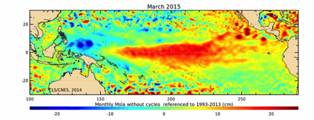
An El Niño has been forecast for this year and the easterly winds over the Pacific ocean have weakened. As a result satellites are already detecting a lower than normal sea level signal in the western equatorial Pacific.
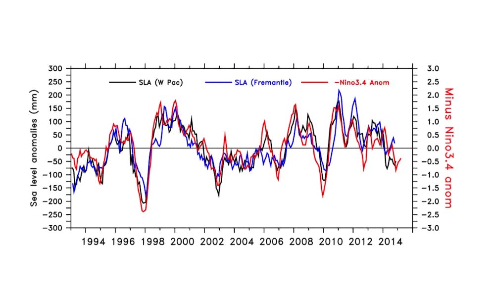
A typical measure of El Niño is the Nino3.4 index which measures sea surface temperatures in the Pacific Ocean. The Nino3.4 index is very strongly correlated with sea level in the western equatorial Pacific.
Sea level at Fremantle is a good indicator of the strength of the Leeuwin Current. It tends to follow the Nino3.4 index and western equatorial sea level observations but with a delay of a few months. This few month delay is the time taken for the sea level change in the western Pacific to influence the strength of the Leeuwin Current near Fremantle.
Given that an El Niño has been forecast for 2015 and the sea level is dropping in the western Pacific, it seems very likely that we will see a weakening in the Leeuwin Current and cooler water temperatures along the coast of WA.
So while eastern Australia watches for heat and drought, El Niño could be the cool relief WA’s oceans have been waiting for.