Articles on Atmospheric science
Displaying 1 - 20 of 97 articles

You might be wondering: what is a ‘Black Nor'easter’, what’s causing all this rain and does it have anything to do with climate change? Here’s what you need to know.

There are an infinite number of paths an ice crystal can take before you touch it.

We know particles from spacecrafts are in the stratosphere. But what this means for the ozone layer or the climate is still unknown.

A surprising number of new consumer tech products promise to improve air quality.

An atmospheric scientist explains how El Niño works, this year’s oddities and why this phenomenon doesn’t last long.

There’s a rule of thumb that rainfall intensity increases by about 7% per degree Celsius as temperatures rise. But the increase is much higher in the mountains, scientists found.

An expert in atmospheric science sheds light on Earth’s energy imbalance and its consequences for humankind.

Cloud seeding – spraying materials into clouds to increase precipitation – has been around for nearly 80 years. But only recently have scientists been able to measure how effective it really is.

Each rainbow is personal – the rainbow you see isn’t exactly the same rainbow the next person sees. It’s all in the eye of the beholder.

Rising temperatures mean longer, earlier pollen seasons, but a bigger problem is what more carbon dioxide will do to the amount of pollen being released.

This year’s Sierra snowpack is looking a lot like 1983’s, and that was a year of flooding and mudslide disasters. A meteorologist explains what’s ahead.

Chlorofluorocarbons (CFCs) are also potent greenhouse gases which contribute to climate change.

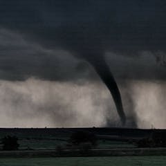
Researchers are turning to computer models, drones and other methods to improve tornado forecasting.

It can be disruptive or refreshing, and we feel it every single day. But do you ever stop to think what creates wind on our planet?

Millions of people around the world suffered through deadly flooding and long-lasting heat waves in 2022. A climate scientist explains the rising risks.

The meteorologist leading NOAA’s 2022 hurricane field program describes flying through eyewalls and the technology in these airborne labs for tracking rapid intensification in real time.

Millions of people around the world suffered through long-lasting heat waves and deadly flash flooding in the summer of 2022. A climate scientist explains the rising risks.

Heat domes are a dangerous part of summer weather.

You can’t photograph the inside of a twister, but radar offers some clues.

If fossil fuel burning stopped, emerging research suggests air temperatures could level off sooner than expected. But that doesn’t mean the damage stops.
