Earth’s magnetic field locks information into lava as it cools into rock. Millions of years later, scientists can decipher this magnetic data to build geologic timelines and maps.
The present landscape near Dongshen, China.
Wan et al.
A big dip in the Earth’s crust may record an ancient continental collision from the dawn of plate tectonics.
Tharp with an undersea map at her desk. Rolled sonar profiles of the ocean floor are on the shelf behind her.
Lamont-Doherty Earth Observatory and the estate of Marie Tharp
Born on July 30, 1920, geologist and cartographer Tharp changed scientific thinking about what lay at the bottom of the ocean – not a featureless flat, but rugged and varied terrain.
Half Dome in California is constituted from granite, a relatively less dense type of rock.
(Shutterstock)
How the earliest continents formed has been a matter of debate. Analysis of zircons in Canada and Australia suggest that those historical processes are similar to current tectonic movements.
Newfoundland and the Canadian mainland, photographed from NASA’s Terra satellite on March 31, 2004.
(Jacques Descloitres, MODIS Rapid Response Team, NASA/GSFC)
New research has found that the continents ended up where they are today because of previous plate tectonic processes that controlled how Pangaea broke apart.
The Immaculate Conception Catholic Church lies in ruins after a magnitude 6.4 earthquake in Guayanilla, Puerto Rico, Jan. 7, 2020.
AP Photo/Carlos Giusti
Puerto Rico’s January earthquakes came after many foreshocks and have been followed by numerous aftershocks. Scientists are studying these sequences to improve earthquake forecasting.
On June 5-6, 2012, NASA’s Solar Dynamics Observatory collected images of one of the rarest predictable solar events: the transit of Venus across the face of the Sun.
NASA/SDO, AIA
This hot, acidic neighbor with its surface veiled in thick clouds hasn’t benefited from the attention showered on Mars and the Moon. But Venus may offer insights into the fate of the Earth.
Material from the Earth’s core has been leaking into the mantle through activity that led to volcanic eruptions such as that helped form the Hawaiian islands.
EPA/Bruce Omori/Paradise Helicopters
Because it happened within the Australian Plate rather than at a plate boundary, shockwaves from the quake travelled more efficiently to Darwin than to cities closer to the epicentre.
Scientists have pieced together Game of Thrones’ geology as the show draws last breath on television.
Kal242382 from Wikimedia Commons
Even in this fantasy world, geological processes like tectonic plate movement, earthquakes and volcanic eruptions would have built the mountains, carved the rivers, and created vast oceans.
Lord Howe Island is part of a volcanic seamount formed around 7 million years ago.
Flickr/Roderick Eime
A new array of seismometers provides a glimpse of what’s happening deep beneath this geologic fault. New data help explain why the north and south of the region are more seismically active than the middle.
Africa’s physical landscape is not a permanent fixture and is being constantly shaped by massive geological forces.
Shutterstock
Seismologists use sensors to build images of the interior of the earth. Making the invisible, visible.
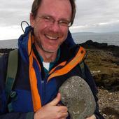
In the field studying the rock association in the Doolena Gap greenstone belt, 30 km north of Marble bar in the Pilbara region of Western Australia.
David Murphy
The remote Pilbara region of Western Australian formed many billions of years ago when the Earth was much hotter and the crust softer than it is today.
Fresh earthquakes and aftershocks hit parts of Papua New Guinea following February’s deadly quake. It’s Australia’s slow push north that’s part of PNG’s seismic activity.