
I’m a scientist and my job is to look below the surface of the earth. One of the questions often asked of people working with what we call geophysical imaging is, “How deep can you see?” It’s a difficult question to answer of course, since one person’s “deep” is another person’s “shallow”, and what is deep to the archaeologist will barely scratch the surface for the planetary seismologist.
For my own part, I’m a “near-surface geophysicist”, interested in the physical properties of material within the upper 100 metres of the ground – the rock, soil and (occasionally) ice located directly in the zone of human interaction – and I’ll often apply ground-penetrating radar to these targets. But there is still a lot that can happen in 100 metres: indeed, go to the right place, and even the top metre of the ground is a bustling metropolis of mammals. And that’s how I ended up investigating an underground meerkat maze for the new BBC series Animals with Cameras.
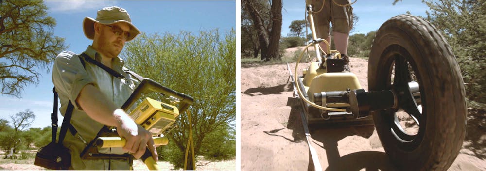
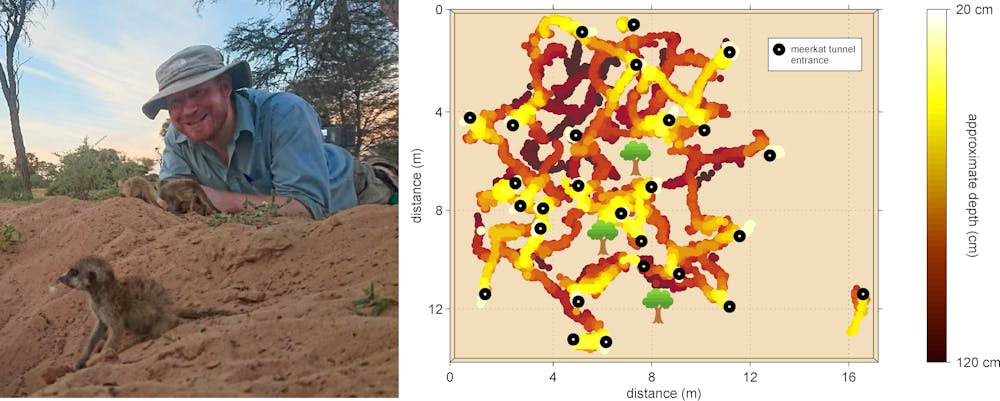
Like many geophysical tools, radar is non-invasive, meaning that we can generate an image of subsurface structures while leaving the ground completely undisturbed. It is quite possible, with the latest 3D positioning and processing techniques, to map out a hole or an animal tunnel down to the finest few centimetres. Armed with this technology, I’ve always found it especially satisfying to collaborate with scientists for whom geophysics offers a brand new perspective such as those at Cambridge University’s Kalahari Meerkat Project.
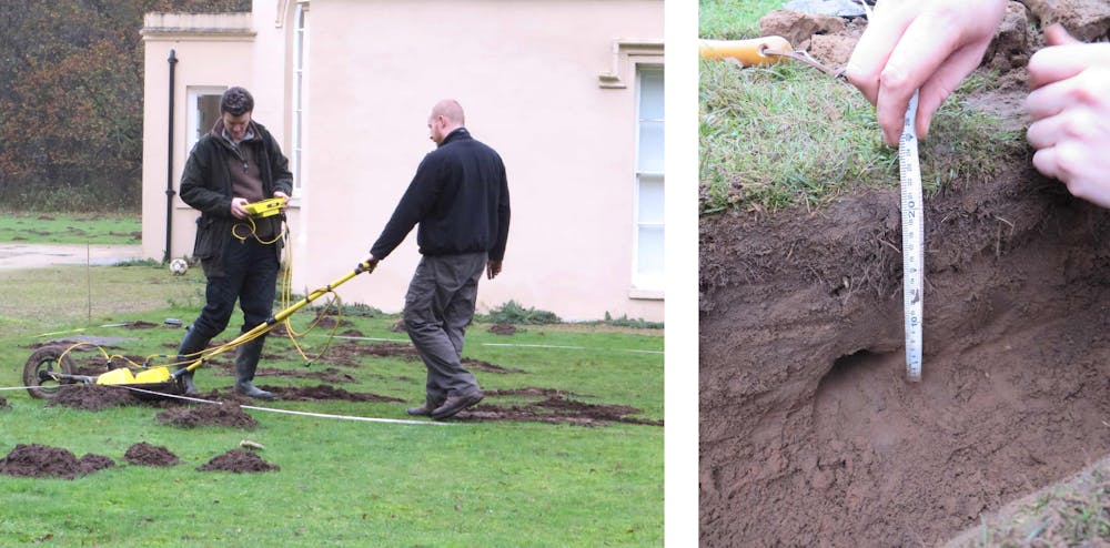
We have known for years that animal burrows can be detected with radar. As far as the radar is concerned, the tunnel represents an elongated cavity that is detectable within the host soil. Animal activity is often present in archaeological datasets (indeed, it was during an archaeological acquisition in Germany that I recognised my first mole tunnel), but it is only in the past few years that burrows have been the target of focused geophysical study. Ecological applications benefit enormously from the high-resolution capability of ground-penetrating radar, and its non-invasiveness is critical for maintaining the ethical integrity of our work: there would be no point in characterising animal behaviour if it was affected by our survey.
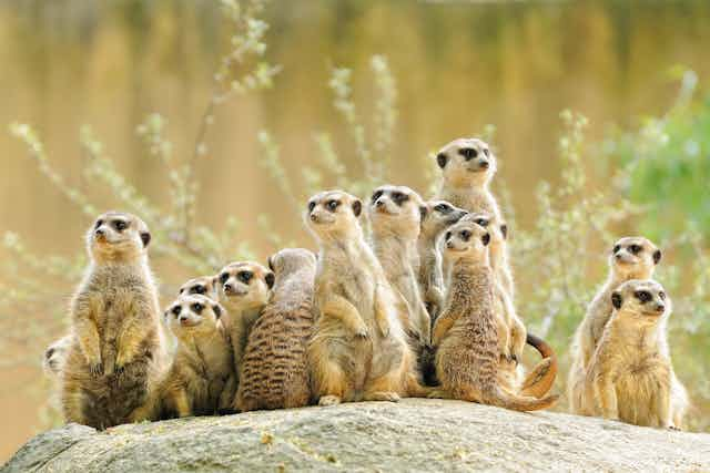
What the radar reveals is quite extraordinary. A family of meerkats, living within an area of 15 sq metres, appears able to excavate around 100 metres of burrows – a tangle of tunnels that makes a London Underground tube map look straightforward – to a depth of around a metre. The idea of the BBC series is to turn the meerkats into miniature cameramen, fitting them with tiny cameras to allow scientists a glimpse into their home. The pure sand of South Africa’s Kalahari desert is a wonderful medium for radar, and we were able to complement the meerkat footage with a first ever 3D map of their tunnel system.
The same technique works with moles, too. Being smaller than meerkats, and living almost entirely underground, moles make a complex system of narrower feeding tunnels – but radar can even see these, despite them being just a few centimetres in diameter.
I have been using radar to monitor time-lapse changes to a mole tunnel network, together with Oxford zoologists Sandra Baker and Stephen Ellwood and geophysicist Niklas Allroggen from Germany’s Potsdam University. It is already clear that the distribution of molehills at the surface is no guaranteed indicator of the complex geometry of the tunnel. But radar sheds light on a more fundamental ecological issue: because animals only dig tunnels if they benefit from doing so, systematic changes to the burrow architecture could hint at particular behavioural patterns.
Applications of geophysical methods in animal ecology are in their infancy, yet other disciplines are already benefiting from our wide experience of detailed imaging of life underground. It will be fascinating to see how widely the observations of meerkat and mole habitats are replicated – both from burrow to burrow, and in comparison with other species.