

Even as Ukraine’s counteroffensive pushes slowly forward, some observers are calling for the warring sides to negotiate a ceasefire. This would create a de facto demarcation line separating areas held by Ukrainian forces from those under Russian control at the moment the fighting stops.
Others argue, however, that a ceasefire is unlikely to lead to a durable settlement. For Ukraine, a truce would mean giving its adversary time to regain strength for renewed aggression, while abandoning its citizens to the horrors of occupation in Russian-controlled areas.
Establishing a provisional line of separation would break up long-established administrative and economic structures. This would indefinitely prevent the divided regions from rebuilding and restoring their inhabitants’ security and welfare.
To understand this, let’s look back at how Soviet leaders drew the border between Russia and Ukraine. It was this border that Ukraine inherited in 1991 after the dissolution of the Soviet Union .
And it was this border that Russian president Vladimir Putin denounced on the eve of Russia’s full-scale invasion of Ukraine in 2022, declaring that modern Ukraine was a historical mistake arising from early Soviet border-making policy.
Map 1. Ukraine in 1991:

As research has shown, Russian and Ukrainian communists who in 1919 mapped out the border between Ukraine and Russia took as their starting point the former Russian empire’s provincial boundaries. These had evolved haphazardly over centuries and reflected neither the geographical distribution of Ukrainian- and Russian-speakers nor economic considerations, such as transport links, the location of industries or flows of goods to markets.
Over the next decade, Moscow repeatedly moved the border with the aim of shaping a Ukrainian Soviet Republic that, while retaining a majority Ukrainian-speaking population, could also build a strong and sustainable economy. This meant drawing borders to facilitate rational planning and the integrated development of industry and agriculture.
In some cases, the Soviet authorities involved local officials and residents in border-making. Regional interests, however, were always subordinated to the needs of the Soviet economy and the imperative of maintaining central political control.
Map 2: Ukrainian borders between 1917 and 1938
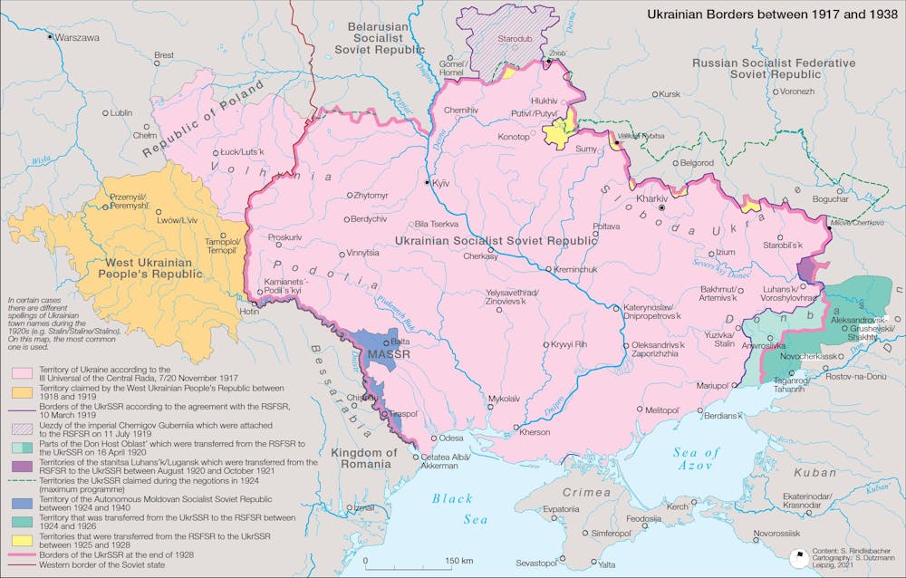
For example, the districts of Shakhty and Taganrog were initially incorporated in the Ukrainian Soviet Republic as they had a majority of Ukrainian speakers. In 1924, however, they were transferred to the Russian Soviet Federative Republic (RSFSR) for economic reasons.
By contrast, Putivl’ district had been allocated in 1919 to the RSFSR, as most of its population was Russian-speaking. Despite this, in 1926 the district was integrated into Soviet Ukraine after Ukrainian officials and local residents made the case that its markets and transport links were within that republic.
In 1954 Soviet leader Nikita Khrushchev transferred the Crimean peninsula to Ukraine. However, this was not a “gift”, as commonly reported, and even less an “exceptionally remarkable act of fraternal aid” on the part of the Russian people, arising from its “generosity” and its “unlimited trust and love” of Ukrainians, as Soviet politicians at the time declared.
Rather, as recent analysis shows, it was a strategic decision with multiple motives. Khrushchev aimed to reinforce central Soviet control over Ukraine by incorporating Crimea’s large ethnic Russian population, after a decade of Ukrainian nationalist insurgency in the newly annexed western regions.
At the same time, Khrushchev hoped the transfer would win him the support of Ukrainian communist elites, bolstering his bid for supreme power in the factional struggle that erupted after Stalin’s death in 1953.
Construction of a vast irrigation system unifying Crimea and southern Ukraine was already under way, to be fed with water from the Kakhovka reservoir on the Dnipro river via the North Crimean canal. For the purposes of planning and carrying out this mega-project, only completed in the mid-1970s, the transfer of Crimea to Ukraine also made economic sense.
Border-making across the Soviet Union attempted similarly to balance many different, often competing, criteria. Where these borders were drawn to a large extent determined the subsequent course of Soviet history and, since 1991, has shaped the internal development and external relations of states and societies across post-Soviet space.
Invasion and annexation
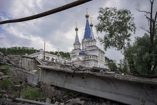
In February 2022 Russia launched its full-scale invasion of Ukraine, seeking to revise the post-1991 border settlement. By that summer its army had occupied large parts of the four eastern Ukrainian regions of Donetsk, Luhansk, Kherson and Zaporizhzhia.
In September, on the Kremlin’s orders, Russian-installed leaders of these regions organised a series of plebiscites. These asked residents in occupied areas if they wished their region to become part of the Russian Federation.
Voting took place watched by armed soldiers and counting was unmonitored. The polls – denounced by UN officials as “illegal” – unsurprisingly yielded vast majorities in favour of joining Russia.
On September 30 2022, Putin declared Russia’s annexation of these regions. Four days later the Russian state Duma ratified this.
However, even at the moment of annexation large parts of these territories remained under Ukrainian control or were threatened with imminent recapture. In November, the Ukrainian army liberated the city of Kherson. Its 2023 counteroffensive is now slowly but steadily taking back land in several areas of the annexed regions.
New state borders?
Where, then, does Russia intend to draw its new state borders? In September 2022, Putin’s spokesman Dmitry Peskov refused to give any answer to this.
He reiterated only that Russia had recognised the independence of the Luhansk and Donetsk People’s Republics within the Ukrainian regional borders that had existed before the declaration of these Russian proxy administrations in 2014.
This implied that Russia envisaged incorporating these regions in their entirety. He said nothing about Kherson and Zaporizhzhia.
A ceasefire along a Korea-style demarcation line would fracture the unified territory that Ukraine inherited in 1991. Over and above the political, strategic, legal and moral objections to an armistice that entrenches territorial partition, this outcome would cause intractable economic problems.
Whether a truce held a few months or many years, it would continue to prevent external investment in the divided regions, draining state resources and preventing vital reconstruction. A stopgap solution without a permanent settlement – a peace treaty – will only create conditions for further suffering and future conflict.