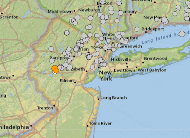

It’s rare to feel earthquakes in the U.S. Northeast, so the magnitude 4.8 earthquake in New Jersey that shook buildings in New York City and was felt from Maryland to Boston on April 5, 2024, drew a lot of questions. It was one of the strongest earthquakes on record in New Jersey, though there were few reports of damage. A smaller, magnitude 3.8 earthquake and several other smaller aftershocks rattled the region a few hours later. We asked geoscientist Gary Solar to explain what causes earthquakes in this region.
What causes earthquakes like this in the US Northeast?
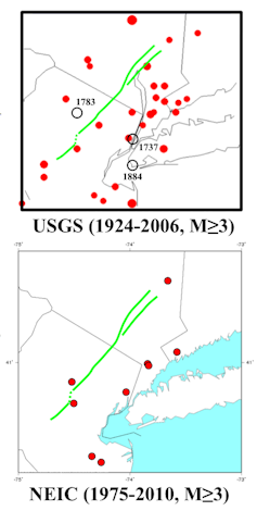
There are many ancient faults in that part of New Jersey that extend through Philadelphia and along the Appalachians, and the other direction, past New York City and into western New England.
These are fractures where gravity can cause the rock on either side to slip, causing the ground to shake. There is no active tectonic plate motion in the area today, but there was about 250 million to 300 million years ago.
The earthquake activity in New Jersey on April 5 is similar to the 3.8 magnitude earthquake that we experienced in 2023 in Buffalo, New York. In both cases, the shaking was from gravitational slip on those ancient structures.
In short, rocks slip a little on steep, preexisting fractures. That’s what happened in New Jersey, assuming there was no man-made trigger.
How dangerous is a 4.8 magnitude earthquake?
Magnitude 4.8 is pretty large, especially for the Northeast, but it’s likely to have minor effects compared with the much larger ones that cause major damage and loss of life.
The scale used to measure earthquakes is logarithmic, so each integer is a factor of 10. That means a magnitude 6 earthquake is 10 times larger than a magnitude 5 earthquake. The bigger ones, like the magnitude 7.4 earthquake in Tawian a few days earlier, are associated with active plate margins, where two tectonic plates meet.
The vulnerability of buildings to a magnitude 4.8 earthquake would depend on the construction. The building codes in places like California are very strict because California has a major plate boundary fault system – the San Andreas system. New Jersey does not, and correspondingly, building codes don’t account for large earthquakes as a result.
How rare are earthquakes in the Northeast, and will New Jersey see more in the same location?
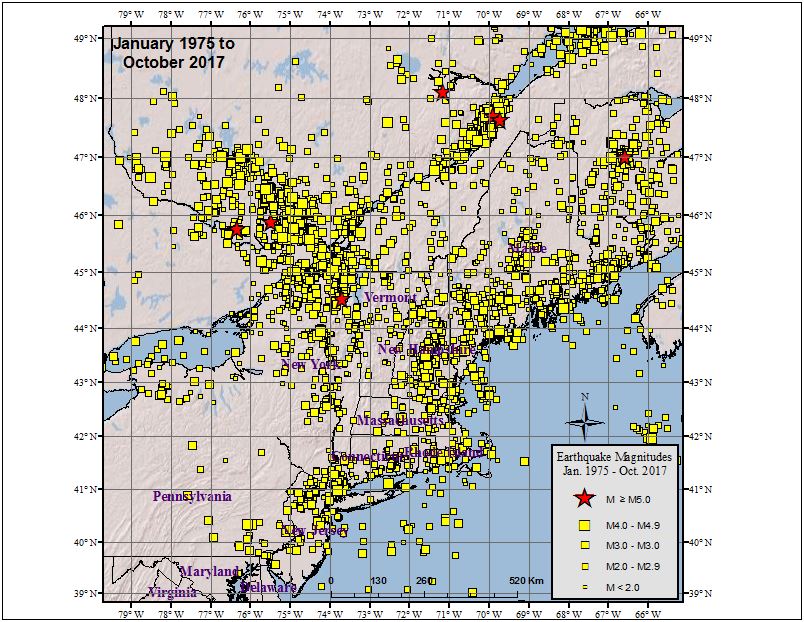
Earthquakes are actually pretty common in the Northeast, but they’re usually so small that few people feel them. The vast majority are magnitude 2.5 or less.
The rare large ones like this are generally not predictable. However, there will likely not be other large earthquakes of similar size in that area for a long time. Once the slip happens in a region like this, the gravitational problem on that ancient fault is typically solved and the system is more stable.
That isn’t the case for active plate margins, like in Turkey, which has had devastating earthquakes in recent years, or rimming the Pacific Ocean. In those areas, tectonic stresses constantly build up as the plates slowly move, and earthquakes are from a failure to stick.
This article, originally published April 5, 2024, has been updated with several smaller aftershocks felt in the region.