


Mount Agung in Bali is currently on the verge of eruption, and more than 100,000 people have been evacuated. However, one of us (Dian) is preparing to go into the area when it erupts, to collect the ash.
This eruption is likely to be catastrophic, spewing lava and ashes at temperatures up to 1,250°C, posing serious risk to humans and their livelihoods. Ash ejected from volcano not only affects aviation and tourism, but can also affect life and cause much nuisance to farmers, burying agricultural land and damaging crops. However, in the long term, the ash will create world’s most productive soils.
Read more: Bali's Mount Agung threatens to erupt for the first time in more than 50 years
While volcanic soils only cover 1% of the world’s land surface, they can support 10% of the world’s population, including some areas with the highest population densities.
The ring of fire
Indonesia is situated on the Pacific Ring of Fire, a chain of volcanoes that stretches from Sumatra through Java and Bali to Timor, and constitutes the most dangerous of the world’s tectonic interfaces.
Throughout history, Indonesia’s volcanic eruptions have affected the world’s climate, notably the volcano of Lake Toba with its super-eruption around 74,000 years ago, which caused a six-year volcanic winter. Mount Tambora is known for its violent eruption in 1815 causing a year without summer in Europe, and the Krakatau explosion in 1883 also cooled the world.
Read more: Explainer: why volcanoes erupt
The eruption of Tambora, on the island of Sumbawa in 1815 ejected an estimated 160 cubic kilometres of ashes into the atmosphere. This catastrophic event affected population in nearby islands, including Bali. Agriculture was destroyed by ash deposits and shortage of sunlight. It was estimated that the misery lasted 10–15 years before the ashes turned into fertile soils.
The 1963-64 eruption of Mt Agung released 0.95 cubic km of solid volcanic material and lava. Some 1,580 people were reportedly killed by the rapid lava flows and accompanying poisonous gases.
But if a comparable eruption occurred tomorrow, the death toll would be greatly lessened by the warning systems now in place.
Implications for neighbouring countries
Among the constant eruptions of Indonesia’s many volcanoes (66 currently being monitored, and among those 50–60 are considered “active”), huge ones will arrive.
They will be enormously destructive to Indonesia, will impact the world’s climate, and will challenge neighbouring countries such as Australia in manage without air traffic while assisting millions of displaced Indonesians to survive and recover.
Read more: The world's five deadliest volcanoes ... and why they're so dangerous
Even the moderate ones that are likely to occur every decade, causing dislocations to hundreds of thousands, need to be prepared for in a systematic way.
Volcanoes and population density
In the past decade, volcanoes in various parts of Indonesia have been quite active and erupted, notably Merapi (2010) in Central Java, Sinabung (2014) in North Sumatra, and Kelud (2014) in East Java.
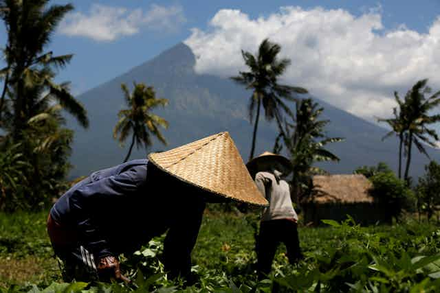
Despite the danger posed by these volcanoes, areas with high volcanic activity also have some of the world’s most fertile farmlands due to release of plant nutrients such as potassium and phosphorus.
Dutch scientist E.C.J. Mohr observed in 1938 that the region near Mount Merapi has higher population densities in areas with soils derived from volcanic ash.
These soils are most probably the reason that Java can sustain high human population densities, estimated at more than 1,100 people per square km. Several years after Mt Galunggung in West Java erupted in April 1982, crop productivity in the local area of Tasikmalaya were boosted.
Volcanic ash, the fertilizer reserve
Dian Fiantis from University of Andalas in Padang is a volcanic ash hunter. She sees volcanic eruptions as an opportunity to study the beginning of how soils formed, a process that could take thousands and even millions of years. She has collected and studied ashes immediately after volcanoes have erupted in Sumatra.
Tephra (the scientific name of volcanic ash) contains primary minerals which have abundance of nutrients. Over time, chemical and biological weathering, the ashes will release the nutrients and the ash will increase its surface area, enable them to hold more nutrients and water.
In addition, it has the capacity to sequester a high amount of carbon (taking carbon out of the atmosphere and put it in the soil).
On January 28, 2014, Mount Sinabung erupted with pyroclastic flow and “mud rain”. Ashes covered most of the Sigarang Garang village, which is located northeast of the foot of volcano. The ashes contains a high amount of nutrients, notably calcium, magnesium, potassium, and phosphate.
It was estimated that the region received 250 million tonnes of ash – the equivalent of up to 10 million tonnes of fertiliser.

When we visited the village in January 2017, we saw some of the ashes were already colonised by lichens, and some even with grasses growing on them. These areas have already accumulated substantial organic matter, up to 4% of organic carbon, meaning they can soak up a large amount of carbon from the atmosphere through plants.
Mohr postulated that Indonesia can sustain such as high population density due to the presence of active volcanoes. But the regular eruptions throughout the country have also caused devastation to the people living around the volcanoes.
This natural phenomenon renews the soil, but it takes time for the ashes to be weathered. We need to work on solutions that will hasten the rate of soil formation. It is a challenge to convince local farmers that the eruption is a blessing in disguise, and that this natural phenomenon ultimately keeps Indonesia’s soils fertile.
We also hope the Australian government will devote its capacity to modelling and preparing for the appropriate response to a major disaster, which is far more likely on a longer time frame.
Cooperation between military and emergency services between Indonesia, Papua New Guinea, and East Timor must begin before the disaster occurs, to establish trust, communication lines, and strategies.