
City planning has many approaches that have been used to enable better economic, social and environmental outcomes. The planning profession has been doing strategic assessments of urban land development opportunities and constraints for over a hundred years but has only recently adopted the techniques of strategic environmental assessment (SEA), a tool developed by the environmental assessment profession.
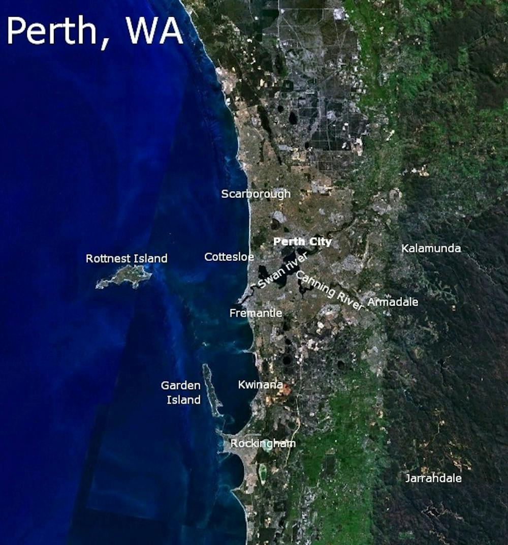
The draft Green Growth Plan for Perth is a federal and state government initiative to trial whether SEA can be integrated into the planning of an Australian city. It is a process in parallel with the traditional strategic plan, which in Perth is the draft Perth and Peel @ 3.5 Million Plan.
Town planning and environmental assessment have largely been competing for the past 30 years to show who knows best about managing urban land. Planning has mostly been setting broad strategic directions based on infrastructure and land zoning, with day-to-day statutory planning devolved to local governments on what should be approved or modified. Environmental protection authorities (EPAs) have set major strategic directions about protection of biodiversity, water and other resources like basic raw materials, as well as making day-to-day decisions on major projects.
Often the division of labour has been to have planning in control of cities and EPAs doing most of the work in regions. This is especially the case in a state like Western Australia where most major projects are in the regions.
EPAs get to provide an opinion on urban land releases or urban regeneration projects, but mostly town planning has the final say in cities. However, there has been a sense that the cumulative effects of lots of small incremental planning decisions, especially urban sprawl, could be having serious impacts on biodiversity, water and the availability of resources like basic raw materials. Growing disquiet about town planning’s ability to manage the environmental side of cities has led to the development of strategic environmental assessment.
SEA takes a broad approach to a large land area and assesses the cumulative impacts over a planning horizon of 50 years or more. The techniques when applied to cities have been based on a combination of old tools, like the McHarg overlays of all the different landscape features from the 1960s, as well as 21st-century tools of digital visualisation and modelling.
SEAs have been sold as helping to reduce the time and cost of environmental and planning approvals. With a strategic plan adopted, it not only shows where development should be avoided but clears the way for development in other areas (see here for the detailed draft map). So it promises better environmental outcomes and faster processes.
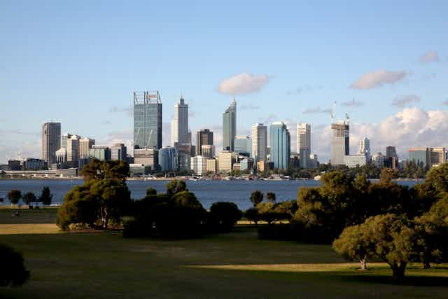
Perth pioneers whole-city SEA
The SEA process is legislated under the federal Environment Protection and Biodiversity Conservation Act while town planning is a state responsibility. The SEA promises much and has been helpful in a number of regional assessments across Australia, including two fringe areas of Melbourne and Sydney. Applying this process to whole cities is a different matter, so many people have been closely watching the first SEA of a city in Australia – the Green Growth Plan for Perth.
The draft report was guided by a partnership between the federal environment department and 20 state government agencies represented on the state steering committee. The report has much detail on “matters of national environmental significance” (MNES). In other SEAs there have been impacts on seven to nine MNES; the Perth Green Growth Plan has impacts on 92 MNES. This is partly due to the complexities of a large city SEA, but mostly it is due to Perth being in the heart of a major global biodiversity hotspot.
There is a recommendation to set aside for protection a further 170,000 hectares of natural areas. Most of this is in government ownership but 20,000 ha needs to be purchased.
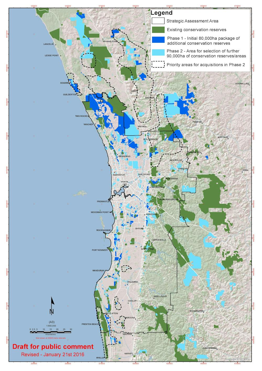
In terms of contiguous green belts that can enable biodiversity to be managed, the majority of the natural space to be set aside is in the northern corridor. In reality this corridor is already close to 100 kilometres long and the cessation of development here will only be mourned by a few developers. Most of the damage has been done.
The southern corridor has much fewer constraints on development. The area is mostly poor agricultural land, so the Green Growth Plan suggests a few small areas for protection. It also proposes some significant new measures to avert decline in the Peel Harvey estuary, notably regulation to improve farm fertiliser management.
Thus, if the SEA is to enable faster development, it will be in the southern corridor along the Kwinana Freeway heading beyond Mandurah towards Bunbury.
Filling in the grey areas
Should this plan be adopted as the basis of Perth’s long-term future? In terms of environmental protection, especially biodiversity, it is a strong statement. It is a literal line in the sand, especially to the north where Perth has sprawled for the past 40 years.
But it is not the whole story. The federal government’s new Smart Cities Plan is designed to help cities do more innovative planning. In particular, it is trying to enable 30-minute cities.
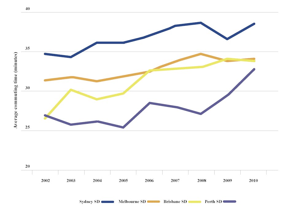
This has been highlighted in much planning discourse as the basis of a more sustainable, liveable and productive city as the travel time budget is being exceeded in all our big cities. As shown below, Sydney has been over 30 minutes for a long time. Perth moved rapidly into this league in its recent boom.
Quite simply this means we need more urban regeneration and less urban sprawl. How do we do this?
Greenfield development is easy because developers can roll out large precincts for development. Brownfield development on old industrial sites in the inner-city areas (like Docklands in Melbourne and Barangaroo in Sydney) are also relatively easy as they are big sites.
But in between we have millions of individual lots, all owned privately. Here, the only option for developers is to do low-quality infill in backyards. This is not working.
To redevelop in these greyfields requires creative, clever planning that finds large sites for regeneration and brings all the owners together, as occurred recently in Castle Hill, St Leonards and Baulkham Hills in Sydney. Unlocking the area for regeneration, using significant innovations in buildings, energy, water, waste, walkability, jobs, services and biodiversity, requires the creation of significant amenity.
This is the basis of the entrepreneur rail model that is meant to provide a rail link to enable such urban activity. The Smart Cities Plan wants cities to prepare City Deals that set out how they can do such things.
The Green Growth Plan is a good base to work from, but it cannot be all that is needed for a future town plan. The draft Perth and Peel @ 3.5 Million Plan suggests ways to consolidate 47% of the next period of urban growth. It suggests that 100% consolidation would be too difficult.
The redevelopment agenda could do with a makeover in Perth to further complement the Green Growth Plan. More Smart City ideas are needed or else the never-ending sprawl of our cities will continue its unsustainable and unproductive march.
Public comment on the Perth Green Growth Plan is being accepted until 5pm on Friday, May 13, 2016.