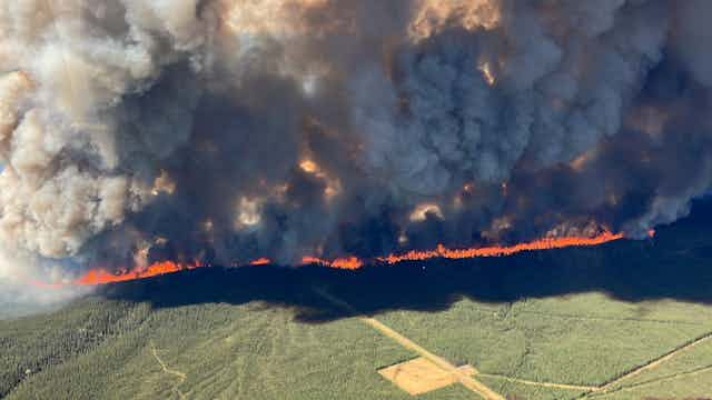

Global warming is here. As anticipated for more than 50 years now, the temperature and levels of atmospheric CO2 have increased.
Various models were able to predict these increases with precision, and we are seeing the impact now. One of the main effects of the changes in the atmosphere are frequent forest fires, which are more common globally and have affected Canada in the last month.
Read more: Wildfires in Alberta spark urgent school discussions about terrors of global climate futures
Complex models
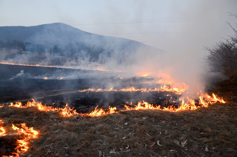
Mathematical models to predict forest fire behaviours were first introduced in the 1940s and they have been evolving for decades. They consider various aspects and their complex interrelationships: the type of forest fuel (grass, shrub, small trees, large ones), the weather (wind direction, temperature, humidity), the topology of the terrain, and the source of the fire (human activity, lightning).
Modelling forest fires and forecasting fire behaviour is a complex endeavour. A model can anticipate the direction and intensity of the fire, and help with evacuation, fire suppression and forecast of smoke pollution. The models can predict fire spread, which helps protect human life, housing and infrastructure, including crucial utility companies assets.
Mathematical models are important, but in the case of forest fires, we also need to build simulation tools to be able to handle the complexity. We need to consider the different types of fire fuels in each region, the localized winds within forest fire areas, variations in climate, whether a fire spreads from the crown of the trees or on the ground, and other variations.
Using a computer to build a virtual laboratory for simulations helps with the prediction process in a safe, risk-free and cost-effective fashion. Experiments can be simulated on a computer to inform better decisions in the field, without affecting the environment, people or infrastructure.
Complex factors, small scale
Our lab — the Advanced Real-Time Simulation lab at Carleton University — has been working on new methodologies for modelling and simulation that improve results at a reduced cost.
We model forest fire behaviour at a microscopic level. This is because models that work on macro, or larger, scales have some constraints when we want to study the low-level interactions between fire, weather and suppression efforts.
Also, traditional models are harder to interface with Geographical Information Systems (GIS) software applications. We need to be able to interface the models with real-world data coming in real time from a variety of sensors: spectrometers, satellites, infrared scanners, laser or 3D remote sensing devices. Building models that can react to external data needs new methodologies.
Our approach divides the geographical space of a fire into small areas and calculates the complex phenomena. Many existing methods study the spread of fire by dividing the area of interest using a regular topology (for instance, rectangles, squares or triangles over the area of study), but these models are more complex to integrate with GIS, which use polygons of many different shapes. Building models with irregular topologies helps with obtaining more precise results.
These techniques help with creating models that are simpler to understand, test and modify.
Similarly, we need the simulations of such models to run efficiently. We defined new parallel simulation algorithms to generate a larger number of simulations in a shorter period of time, improving the quality of the results.
We also used advanced calculation approaches that include advancing the simulation time irregularly (when important events are detected), as well as techniques to detect higher levels of activity in the simulation. These techniques allow us to pay more attention to the forest fire sections that need more calculations per second, without computing the equations where they are not needed. This saves simulation time and improves precision of the results.
Informed decision-making
Numerous government agencies — such as the U.S.-based National Center for Atmospheric Research — use various modelling and simulation tools like FireSmoke, Fire M3 and FireMars. These tools include web-based support for decision-makers and provide information to the general public.
To improve such tools, advanced research is needed in the field of web-based modelling and distributed simulation, which allows the software to run in remote sites.
The future of forest fire research includes more sophisticated sensors, new artificial intelligence predictive methods, modelling based on Big Data algorithms and advanced visualization software to enhance the decision-making process.
We need to be prepared for future rounds of forest fires, and modelling and simulation can help in this complex effort.