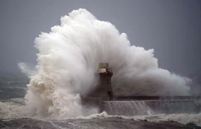

Storm Babet has caused havoc across the UK, with strong winds and rough seas along the east coast, record breaking rainfall and river levels in Scotland, overtopped flood defences, closed roads and railways and sadly at least two deaths. The impacts are not over as further rain is expected.
The risk was clear well before the event. Storm Babet was officially named by the UK Met Office on Monday October 16 and a rare red weather warning was issued on the Wednesday, 32 hours before the heaviest rain started.
Red weather warnings are used by the Met Office to communicate extreme weather events that pose a risk to life. This was only the fourth time a red warning had been issued for rainfall.

The Scottish Government’s Resilience Operation was activated, flood defences were closed, roads and bridges shut, households evacuated and emergency rest centres opened. These advance warnings undoubtedly kept many people safe.
How did forecasters know it was coming?
Meteorologists were tracking the storm using satellites and weather observations. Every day they became more confident about when and where the heaviest rainfall would land.
Storm Babet is an unusual weather system. Storms that hit the UK in the autumn and winter normally come from the west across the Atlantic, but Babet instead travelled from Portugal, picking up moisture from the Bay of Biscay before being trapped over the UK by a hard-to-budge high pressure system across Scandinavia. This resulted in a prolonged period of wet and windy weather and widespread flooding.

The heaviest rainfall has been over the Angus hills in eastern Scotland, visible in white and black in the map below. As UK weather systems tend to come from the west, dumping their rain over the first hills they encounter, the eastern side of Scotland is usually protected from the worst of the weather. That is why forecasters were particularly concerned.
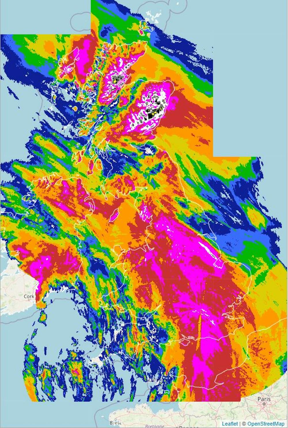
The previous highest 24-hour rainfall in the area was 100mm recorded in November 2022, with 60mm-70mm recorded during Storm Frank in 2015. The rainfall from Storm Babet is already over 160mm. Unlike those in western Scotland, rivers in the region are simply not big enough to carry that much rainfall without bursting their banks.

What hydrologists knew
Hydrologists such as myself study how water moves across and through the landscape, which is key to forecasting floods. Alongside the exceptionally high rainfall, other factors made Angus and south-east Aberdeenshire particularly vulnerable. The hills funnel water into steep rivers that rise quickly and rush towards the sea, so towns and villages along them are no strangers to floods.
In this instance, heavy rain ten days ago meant that the ground was already saturated. Instead of soaking into the ground, any rain that fell during Storm Babet would quickly have flowed into the streams and rivers causing them to overflow.
A storm like this is far beyond anything experienced in living memory of those in the region. Without any first hand knowledge to rely on, computer models help forecasters identify where the biggest floods will be. With Babet, hydrological models were able to pinpoint the area of concern (the red weather warning) to the rivers draining off the Angus hills.

Similar models predicted that the South Esk river would rise above its flood defences in the town of Brechin, meaning flood warnings could be issued and the difficult decision to evacuate 400 residents to safety could be made on Thursday afternoon rather than in the middle of the night. It turned out to be good decision, as by Friday morning the river in Brechin was at its highest level on record, and had indeed breached its defences.
Preparing for more extreme events in the future
This is yet another reminder that the climate is changing and we will see more extreme rainfall, putting more people at risk. The “Clausius-Clapeyron” relationship states that for every 1°C increase in air temperature there is 7% more moisture – meaning that there is more rainfall in a given downpour.
The relationship between this and flooding is more complex since it also involves interactions with the landscape (How have urban areas expanded? Are there many trees? What sort of farms are there? Are rivers forced into embankments or allowed to meander through floodplains?).
But understanding these interactions is urgent. The Brechin flood defences were completed in 2016 and designed to protect the town from floods up to a 1-in-200-year event. No one expected them to be topped less than ten years later.
Despite the devastation evident today, the value of advance warnings for Storm Babet for saving lives, property and infrastructure is clear. To help the UK be better prepared for floods, many hydrologists – including me – are working together through the new UK Flood Hydrology Roadmap to further improve the science and data underlying those warnings.

Don’t have time to read about climate change as much as you’d like?
Get a weekly roundup in your inbox instead. Every Wednesday, The Conversation’s environment editor writes Imagine, a short email that goes a little deeper into just one climate issue. Join the 20,000+ readers who’ve subscribed so far.