
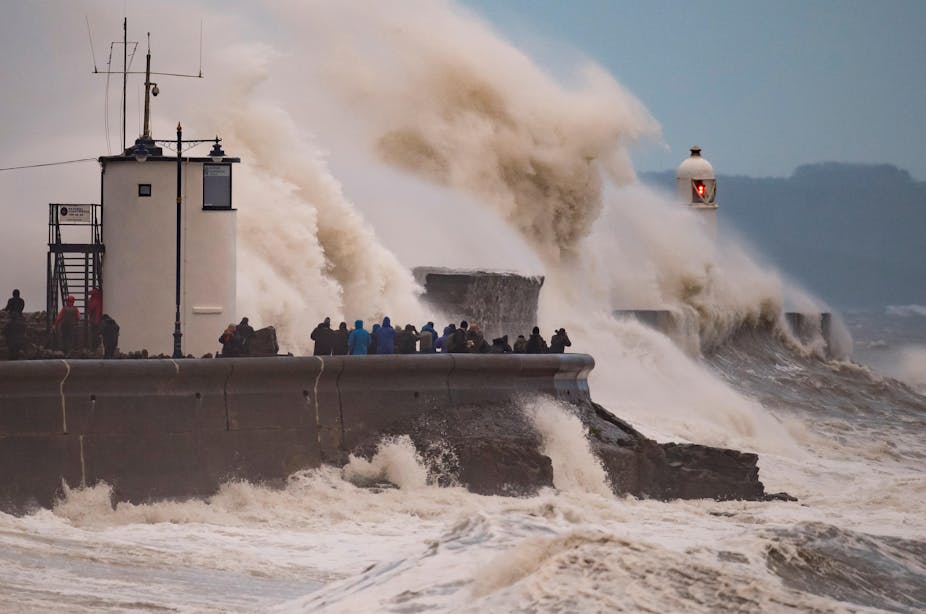
Storm Otto, which was named by the Danish Meteorological Institute, hit Scotland and north-east England last Friday (February 17 2023) with wind gusts of over 80mph, disrupting power to 61,000 homes.
Otto was the first named storm of the UK’s current winter storm season and the first to hit the country’s shores since storms Dudley, Eunice and Franklin last February. Over the course of a week, these three storms barrelled in from the North Atlantic causing wind and flood damage worth over €3.7 billion (£3.2 billion) in insured losses across Europe.
The UK has seen only a few notable instances of stormy weather so far this winter. For example, heavy rainfall in the first few weeks of January led to flooding on the Somerset Levels. But this storm was not intense enough to be named. This happens only when a storm has the potential to be severe enough to cause an amber or red warning.
But storms are a common feature of winters in the UK. Since the current naming scheme started in 2016, between five and ten named storms have hit the UK each winter. So what’s been going on with the weather this year and why did the UK wait such a long time between named storms?
Variable UK weather
Chance can always play a role, particularly in the case of UK weather.
A narrow band of strong winds in the upper atmosphere, known as the jet stream, steers storms that originate over the North Atlantic towards Europe and the UK. But the jet stream itself is naturally very variable and can shift in position and strength. This can cause the UK’s weather to vary a lot from year to year.
The UK has therefore gone long periods without large storms before. For example, the winter of 1985-86 was relatively quiet and was marked by storms at either end of the season with only one strong storm in January.
La Niña conditions
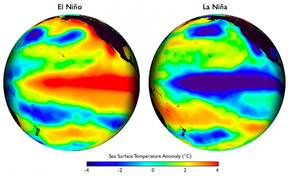
A global weather phenomenon called La Niña is also likely to have contributed to this year’s weather. La Niña is one phase of the El Niño Southern Oscillation and is characterised by relatively cool sea surface temperatures in tropical areas of the Pacific. This winter, sea surface temperatures in the tropical Pacific Ocean have been nearly 1°C cooler than average.
La Niña can influence the weather experienced in the northern hemisphere. Cooler sea surface temperatures in the Pacific shift the position of rainfall in the tropics. These changes then propagate into the mid-latitudes, almost like ripples on a pond, and influence the position of the jet stream over the North Atlantic.
The impact of La Niña on weather in the North Atlantic is different in early and late winter.
Early in the season, La Niña tends to shift the jet stream to the south, steering storms that would normally hit the UK towards southern Europe. This may partly explain the bouts of stormy weather that brought flooding to Portugal, Spain and Italy in November and December of 2022. On December 7, flash flooding swept through the streets of Lisbon, the capital of Portugal, after 82.3mm of rain fell in 24 hours.
Sudden stratospheric warming
Later in the winter season, La Niña tends to shift the jet stream back towards the north and should bring stormier weather to the UK. During a typical winter, cooling air causes a vortex of westerly winds to form in the stratosphere, 10-50km above the Arctic.
The stratospheric polar vortex, as it is called, remains remarkably stable most winters. But some years, the polar vortex slows and breaks up suddenly, causing the stratospheric air over the Arctic to warm rapidly. Called a sudden stratospheric warming, such an event has been occurring since mid-February.
These sudden stratospheric warmings, and the rapid slow down of the polar vortex, causes the North Atlantic jet stream below to slow down and meander. In some cases, sudden stratospheric warming can create a large area of high pressure over the North Atlantic and Scandinavia, bringing a spell of dry weather to northern Europe. This happened following the last sudden stratospheric warming event in January 2021.
But the effect of a sudden stratospheric warming on the UK’s weather can vary. The European blocking associated with sudden stratospheric warming can sometimes bring in freezing air from Europe, increasing the risk of snow. This was the case in late February 2018, where a sudden stratospheric warming drew winds from the Eurasian continent, causing storms and severe snowfall to affect much of the UK – known as the “beast from the east”.
Although the UK might expect some colder weather in the next few weeks, there is no indication in current weather forecasts that this year’s sudden stratospheric warming will lead to the extreme cold weather seen in 2018.
This winter has been less stormy than usual. Yet, the UK relies on rain from North Atlantic storms to refill its rivers, reservoirs and aquifers. This is particularly important this year given last year’s exceptionally hot and dry summer that lead to drought conditions in much of the UK.
Despite only having one named storm, rainfall across most of the UK has fortunately been around or above average since October. This has helped to replenish water resources. But even then, East Anglia and Cornwall remain in drought. So to top up the UK’s water resources and banish the spectre of a 2023 drought, a few more moderate storms over the next few months would be very welcome.

Don’t have time to read about climate change as much as you’d like?
Get a weekly roundup in your inbox instead. Every Wednesday, The Conversation’s environment editor writes Imagine, a short email that goes a little deeper into just one climate issue. Join the 10,000+ readers who’ve subscribed so far.