
When scientists from Imperial College released a simulation of a tsunami, triggered by a vast undersea landslide at Storrega off the coast of Norway around 6000 BC, it probably came as a surprise to many in north-west Europe that their reassuringly safe part of the world had been subject to such a cataclysmic event.
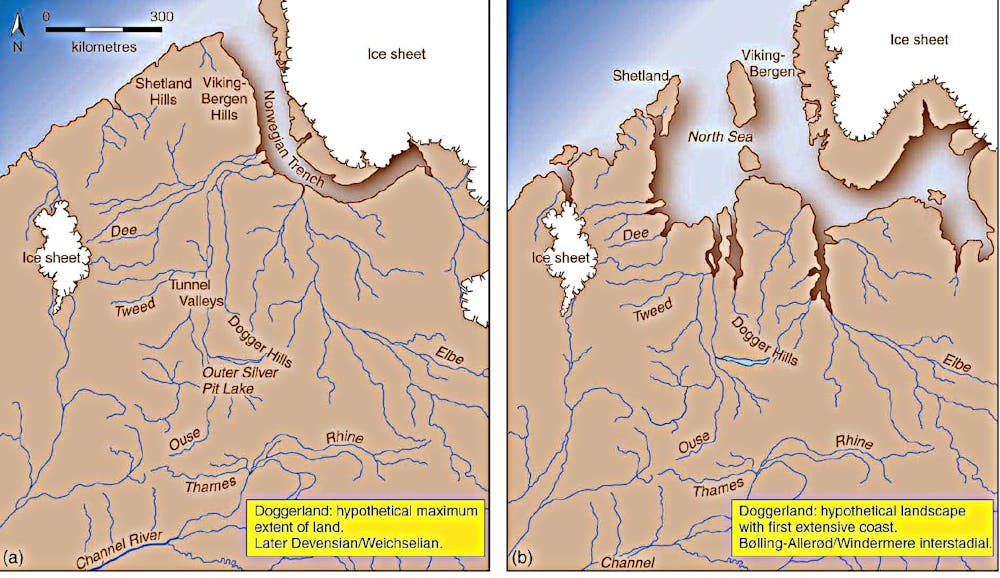
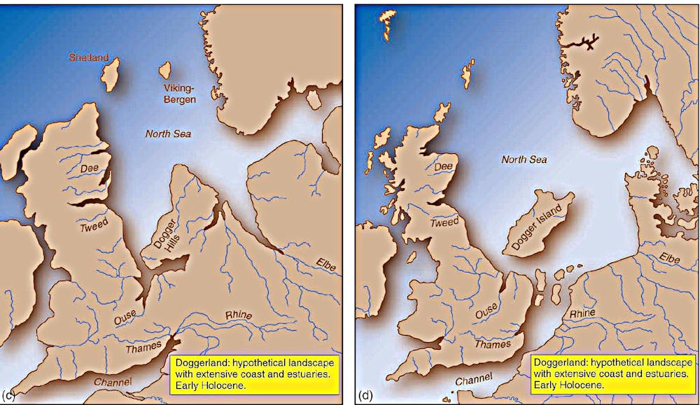
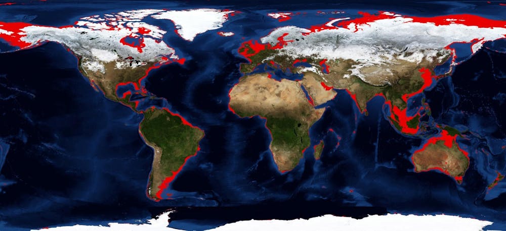
The researchers suggest that this succession of destructive waves up to 14 metres high may have depopulated an area that is now in the middle of the North Sea, known as Doggerland. However, melting ice at the end of the last ice age around 18,000 years ago led to rising sea levels that inundated vast areas of continental shelves around the world. These landscapes, which had been home to populations of hunter gatherers for thousands of years were gradually overwhelmed by millions of tonnes of meltwater swelling the ocean. Doggerland, essentially an entire prehistoric European country, disappeared beneath the North Sea, its physical remains preserved beneath the marine silts but lost to memory.
Although effectively untouched and largely untouchable, the existence of these landscapes had been appreciated since the 19th century. Their potential significance was such that the archaeologist Graham Clark, father of British Mesolithic studies, wrote in 1936 that: “It would be possible to take comfort from the fact that such cultures might not have existed, were it not eminently probable that they not only existed, but flourished, under conditions more favourable than those inland.”
For more than 60 years after this the unreachable nature of Doggerland ensured that archaeologists knew very little about the settlement or even the people of these drowned lands. So little in fact, that it is probably correct to say that the only inhabited lands on Earth that remain to be significantly explored are those lost to the oceans. Indeed, Professor Geoff Bailey, at the University of York, recently suggested that across the world they represent one of “the last frontiers of geographical and archaeological exploration”.
Doggerland after the ice age
In the past decade, however, a phenomenal amount of work has begun to shed light on this inundated landscape. The increasing appreciation of the length of human occupation of north-west Europe, currently thought to stretch back around 900,000 years and understanding that for much of this time Britain was not an island, but a peninsular of Europe, has stimulated research.
A number of dramatic new archaeological finds have given us clues to the extent to which these drowned landscapes are preserved beneath the sea. These include a Neanderthal skull fragment from the Zeeland Ridges off the coast of the Netherlands and a collection of 75 Neanderthal stone tools and animal remains from off the coast of East Anglia, both dating to the Middle Palaeolithic – some 50,000 to 300,000 years ago.
Another development relates to work by researchers at the University of Birmingham that uses seismic reflection data gathered by the offshore oil and gas industry at a cost of hundreds of millions of dollars. Using this information, archaeologists have been able to map the surviving prehistoric landscapes beneath the North Sea silts. Hills, rivers, streams, estuaries, lakes and marshes can now be identified.
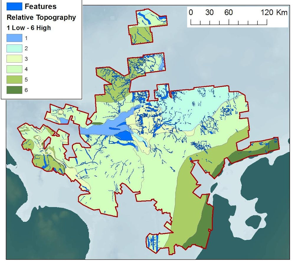
Recent projects supported by English Heritage, the US National Oceanic and Atmospheric Administration (NOAA) and seismic survey company PGS have mapped a previously unseen Mesolithic country of more than 45,000km2, about the size of the Netherlands.
Returning to the Storrega Tsunami, no doubt this was a truly catastrophic event and certainly a major event that played out toward the end of Doggerland’s history. But the truth was that Doggerland had been slowly submerging for thousands of years. The heartland of north-west Europe would have been constantly shrinking, in a way that would have been obvious to its inhabitants. Sometimes slowly and on occasions terrifyingly quickly, the sea inevitably reclaimed ancestral hunting grounds, campsites and landmarks.
Consequently, the final force driving research interest in Doggerland must be the inexorable effects of climate change. The loss of Doggerland was the last time modern humans experienced climate change at the scale currently projected by climate scientists. It can be appreciated that the prehistoric sea-level rise that resulted in the loss of these vast areas of land was caused by natural rather than anthropogenic factors. And also, that the extensive loss of such land, while devastating to those that lived there, was never likely to amount to an extinction-level event.
The Mesolithic communities of the great plains of north-western Europe were flexible and mobile in the face of such change. Suffering there must have been, but they moved and adapted. Modern populations, however, do not necessarily have such a luxury in a world with far more people to share its finite resources and where the majority of the urban centres lie on coastlines. And because of that, the history of Doggerland, and other drowned lands, should rise above the status of historical curiosity to that of a record of a critical period in human history that we would be well advised to study.