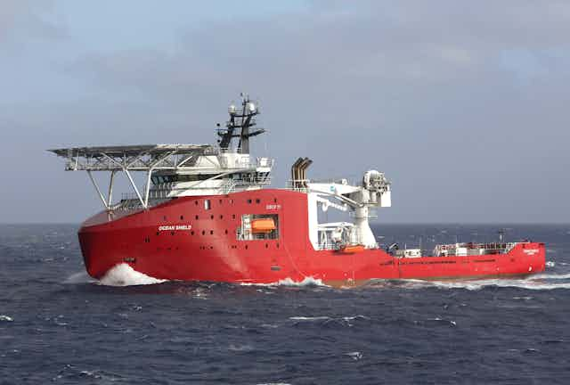
Another phase of the search for missing flight MH370 off Western Australia has drawn to a close with still no evidence of the aircraft’s final resting place.
It comes as reports from the US say the four acoustic pings heard in the area are no longer thought to be from the aircraft’s flight data recorders.
A US Navy official told CNN the “best theory” now is that the sounds heard underwater were more likely from the ship towing the pinger locator, or from the locator itself.
A Navy spokesman referred to the comments by Michael Dean, the Navy’s deputy director of ocean engineering, as “speculative and premature”. But he deferred any further comment to the Australian authorities leading the search effort.
The Australia Government’s Joint Agency Coordination Centre (JACC) then issued a statement saying the underwater search using the Bluefin-21 had found “no signs of aircraft debris” in the search area off Western Australia.
Since Bluefin-21 has been involved in the search, it has scoured over 850 square kilometres of the ocean floor looking for signs of the missing aircraft.
The Australian Transport Safety Bureau (ATSB) has advised that the search in the vicinity of the acoustic detections can now be considered complete and in its professional judgement, the area can now be discounted as the final resting place of MH370.
So where is MH370?
It’s become one of the greatest mysteries in aviation history. The Malaysia Airlines Boeing 777 left Kuala Lumpur International Airport on March 8 headed for China’s capital Beijing with 239 passengers and crew on board.
The flight was tracked on its route to a handover point between Malaysian and Vietnamese air traffic control.
Where the aircraft went next is the big question. We only really know it never made it to Beijing.
The JACC says the expert working group will continue to review the radar and satellite data, and aircraft performance data to determine where the aircraft most likely entered the water.
But the concern must be that any compounding errors in the assumptions underpinning that analysis (and there must be many of them) could lead to a result being significantly distant from the “X marks the spot” outcome needed and wanted, especially by the relatives of the passengers and crew.
Nonetheless, the interpretation of the satellite communication doppler effect seems to be all the authorities now have to try to reduce the search area for MH370.
The reality is there is still no hard evidence to suggest where the aircraft is. There is yet to be validation of any of the assumptions and decisions taken in the search.
If the pings detected were indeed spurious, then all that’s been achieved by the search in the area of the pings off Western Australia, is perhaps proving part of where the aircraft is not.
What now for the search
So what are the proven facts in relation to the disappearance of MH370?
Communication with the aircraft was lost, the transponders stopped transmitting and it didn’t arrive in Beijing. Neither was it reported to have arrived at any other airport.
That’s it.
Everything else has an element of speculation or assumptions which are yet to be corroborated.
The Malaysian military primary radar returns suggesting an aircraft flew across the Malaysian peninsula is assumed to be MH370 and this seems to be corroborated by the satellite data interpretation.
Inmarsat and others have tested their satellite data analysis modelling against other flights where the flightpath is known. It seems that testing has increased confidence in the prediction that MH370 turned back across the Malaysian peninsula and flew on to the Southern Indian Ocean.
But only finding the wreckage somewhere in the Southern Indian Ocean will prove beyond doubt that all the assumptions involved were correct.
Search continues off WA
The search isn’t over off the West Australian coast – just the Bluefin-21’s part which is now complete. The device is limited to a maximum depth of 4,500 metres and the Southern Indian Ocean is much deeper in parts.

The Australian Transport Safety Bureau (ATSB) is working with the Chinese Navy to carry out a bathymetric survey that should be able reach to the 6,000 metre ocean depth. Depending on the weather it could take up to three months to comple the survey.
Yet clearly the search authorities are hopeful the bathymetric survey equipment deployed has the fidelity to detect objects the size of the aircraft, or smaller pieces of wreckage, on the ocean floor.
If not, one wonders what’s the benefit of completing a topographical mapping of the ocean floor when the aircraft could still be undetected anywhere on that topography.
The ATSB is also reviewing all the data from the search including the raw satellite data from the aAircraft Communications Addressing and Reporting System (ACARS).
It was this data analysed by Inmarsat which first suggested the aircraft may have headed for the Southern Indian Ocean.
Will we ever know the fate of MH370?
Clearly the analysis of the satellite and aircraft performance data is the last hope to narrow the search area. If the accuracy of the predictions can be enhanced, as the analysis models are tested and refined, then it may be possible for authorities to concentrate on one area of ocean, albeit even then it’ll likely be a very large one.
Given then the difficulty of actually finding the aircraft on the ocean floor in the search area, authorities are going to still need a large dose of luck to find the aircraft in the vast Southern Indian Ocean.
It may take years and the longer it takes, the greater will grow the pressure from those holding the purse strings to call off the search.
We surely wish them luck. Like the relatives and many other interested parties, we’d really like to know the true lessons from MH370.

