


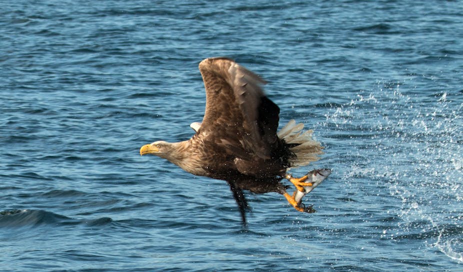
Monitoring natural resources, biodiversity and wildlife data is crucial for economic and ecological sustainability. But in areas that are hard to reach, monitoring becomes a problem. In Scotland, for example rare eagles and plants in need of protection are found in deserted locations. It takes many man hours to keep tabs on these places but technology is being developed to enable remotely located cameras to do the work for us.
Traditionally, environmental monitoring is carried out with environmental sensors and cameras. These are sent into an area such as a moor or a forest to observe activity over a period of time. This is difficult in environmentally harsh areas such as the Cairngorms, where distances can be large and tracks can be inaccessible in winter.
In many cases, remote monitoring is the answer. Typically using small battery powered cameras that trigger whenever any form of movement is detected. The user needs to visit the site again to retrieve the pictures and replace the batteries. Another alternative is to use web cameras, but these typically consume more power and rely on communications infrastructure. About a quarter of Scotland does not have even mobile coverage and many remote areas are without power.
We’ve designed an autonomous system for remote environmental monitoring that seeks to get around this problem. The Wireless Internet Sensing Environment (WiSE) uses satellite internet and solar power to continue to function even where no infrastructure is available on the ground. It takes still images and videos of wildlife such as eagles and deer. This allows us to understand their behaviour, monitor their movements, and combine this with other sensor data to make decisions about land management.
Environmental data like temperature and light level are also being recorded, which helps to understand the effect of the physical environment on wildlife. By tracking changes in plants and wildlife we could, in the future, put together a picture of how patterns of land use or climate change is affecting biodiversity in an area.
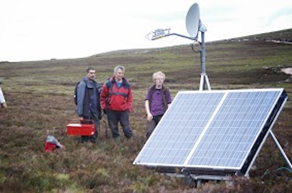
The first deployment of WiSE took place in July 2013 at a Scottish upland mountaintop on the edge of the Cairngorms National Park. The area is about two hours from Aberdeen by road, with the final stretch only accessible in a 4x4 vehicle.
Instead of a person visiting the cameras monitoring an area to collect recordings, the device enables scientists and land managers to retrieve images over a satellite link. This not only saves the person hours for each visit but also enables valuable resources to be managed in more efficient ways.
One of the biggest problems when digital monitoring uses existing commercial camera systems is the volume of unimportant data that can be produced. Commercial cameras start recording after a single trigger, such as the movement of an animal. But they can also be triggered by many things apart from the intended event, such as trees or heather blowing in the wind, or changes in the patterns of clouds overhead. Instead, WiSE combines multiple sensor inputs to more reliably detect events of interest. And when the image data is processed, only the events of interest are put through for later analysis, allowing us to isolate pictures of a mammal or bird visiting the site. This really reduces the analysis time needed by ecologists and support staff.
To do this, the WiSE platform combines hardware components such as sensors, a satellite terminal, cameras, solar power supply, and a central processing gateway. The gateway automate data collection using Raspberry Pi and Arduino microcontrollers. The whole system is reconfigurable, enabling people to modify camera settings remotely. So it can be tailored to respond to different events and software can be upgraded without anyone actually having to go out to a camera.
We plan to augment the system by incorporating more sensors, including humidity and air quality to better understand the physical environment and its effect on wildlife.
WiSE makes environmental monitoring a lot easier, and bringing results back faster to land managers and ecologists. In the future, the platform could be used for other purposes. This includes monitoring roads or rail conditions or for looking after assets in remote locations such as a building site or civil engineering work. And there are even plans afoot to test the system in even more challenging conditions, such as in the Arctic.

Update: Fierce gales swept across Scotland just after this article was published. With gusts of up to 80 miles per hour, the weather was so severe that our satellite was damaged. The frame holding the satellite snapped and the dish was blown to the ground. A site visit is now being planned to restore the system.