
If you feel that the earth beneath your feet is moving, it’s because it is.
Since the late 1980s geophysicists including myself have been building a network of advanced Global Positioning System (GPS) instruments to monitor the Earth. These instruments are sophisticated versions of those in smart phones or sat-nav and allow us to determine positions of bedrock or buildings at the level of millimetres instead of metres.
With 10,000 or more instruments now spread across the globe, one thing has become clear: the Earth’s surface is constantly changing its direction of travel.
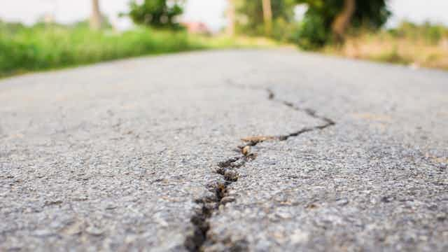
The reason? Earthquakes. Unlike Australia, much of the world regularly experiences earthquakes. For instance, more than half of the US population lives in areas exposed to “potentially damaging ground shaking from earthquakes”. Those earthquakes do more than shake the Earth – they change its shape in the process.
When the shaking stops
But the changes to Earth’s shape don’t stop when the shaking stops.
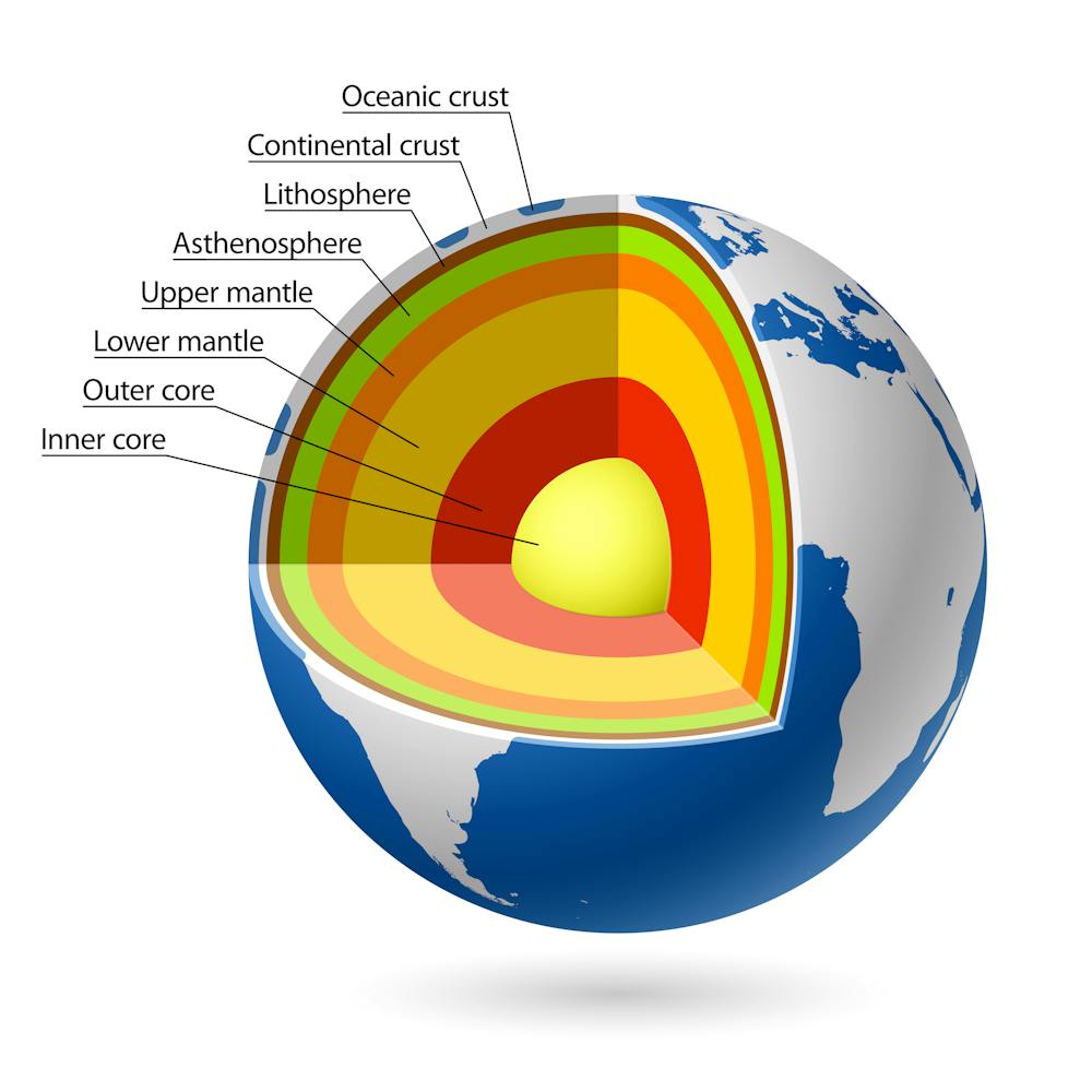
Earthquakes occur because of a rapid release of stress that has built up in the Earth’s hard outer crust. When that happens it is followed by a relaxation deeper within the Earth – within the asthenosphere and mantle – the Earth’s equivalent of the relaxation your stressed body feels after a vigorous massage.
We can track the Earth’s movement between, during and after earthquakes using our network of GPS instruments.
Most of the time, and in most places, any movement is dominated by movement of Earth’s tectonic plates. For example, dozens of GPS units across Australia show it to be moving northeast at a speed of six centimetres per year due to the motion of the Australian plate.
But a closer look at the data shows that this motion is often not in a perfectly straight line.
The restless Earth
In 2013, Australian colleagues used GPS to show that southeast Australia’s speed and direction of motion changed immediately after a magnitude 8.1 earthquake in December 2004 near Macquarie Island, more than 1,500km south of Tasmania.
This slight shift has persisted through to today and was detected as far north as Canberra. In a recent study we show that Antarctica, which is also largely free from large earthquakes, changed direction in 1998 following a magnitude 8.2 earthquake more than 500km to its north.
These examples are from two of the least seismically active regions of the Earth. The changes are much more frequent and much larger in the more seismically active parts of the world.
Examination of old surveying data from regions such as southern California highlights that these changes can be ongoing for many decades or longer. So while the Earth may be relaxing following earthquakes, the Earth is never at rest.
We all rely on millimetres
Why do such small changes matter? After all, we’re talking about changes that may take a decade or longer to travel the length of a ruler.
But millimetres do matter to all of us because our lives are increasingly built on GPS. We position ourselves with GPS, our tractors and roadwork machinery are controlled by GPS and the boundaries of our properties are surveyed with GPS. Modified smart phones can now even be positioned with centimetre accuracy.
If the average person using GPS wants to reliably map or place something with an accuracy of even 10cm then the reference network that underpins positioning must be substantially more accurate and stable. We need that underpinning network to be accurately determined at a level of a few millimetres over decades.
To meet this demand, Australia is preparing to update the datum that underpins all positioning in Australia by 2020.
Poking the planet with a big stick
Understanding what happens after an earthquake can do more for humanity than helping us navigate better. It offers an insight into understanding how the earth beneath our feet works.
Of the 6,370km from Earth’s surface to its centre, the deepest hole that has ever been drilled covers just 12.26km of that distance.
So our understanding of what lies deeper within the Earth depends on making inferences using the surface measurements and theoretical advances in fields such as seismology and geodesy.
Effectively, earthquakes poke Earth with a big stick, and we measure its responses. GPS measurements of this kind add crucial information to our developing picture of Earth’s interior.
While prediction of earthquakes remains impossible, understanding how Earth works is essential to any future progress. At the same time, rapid GPS positioning is now forming part of earthquake and tsunami early warnings, which help people living in such regions to seek safe shelter.
When it comes to understanding what happens between, during and after earthquakes, we’re heading in the right direction.