


In 1910, Paris was subject to a historic flood that is still remembered, and it’s far from a unique event. In France, the risk of flooding is the number-one natural hazard, affecting one in four people, or 17 million residents. Rising river levels are a natural phenomenon that can lead – depending on their intensity (height, speed), duration and geographical reach – to overflow flooding (where the river breaks its banks), and half of all floods are linked to water runoff.
Risk, hazard and vulnerability
Flood risk, flood hazard, and flood vulnerability: in everyday language, these terms are often used synonymously, although each has its own precise definition:
A flood hazard is a hydrological concept referring to rising river water levels;
Flood vulnerability is a sociological concept related to the damage flooding would cause in a given area. For example, a field or a forest might have low vulnerability, since vegetation can easily tolerate being submerged for short periods of time. However, if an electrical goods store is built on the same site, its level of vulnerability would increase significantly.
Flood risk is a combination of hazard and vulnerability. An extraordinary flood caused by a remarkable rise in water levels in an uninhabited area presents no risk, since there is no vulnerability. On the other hand, a relatively moderate flood in a shopping centre would have severe economic consequences and therefore present a high level of risk.
These concepts enable us to establish water level alert thresholds (yellow, orange, red), corresponding to rising levels of danger, for a given point on a waterway.
How are water levels monitored?
In France, the national flood forecast network monitors more than a thousand points across the major waterways. Made up of regional flood forecast services (Services de prévision des crues or SPCs) and a central service (Service central d’hydrométéorologie et d’appui à la prévision des inondations, or SCHAPI) run by the Environmental Department, this network uses flood forecasting models to predict hazards a few hours or days in advance, depending on the effectiveness of the catchment basins.
Some – such as GRP and AÏGA developed by the IRSTEA research institute and used in many regional SPCs – are hydrological models. These use information provided by Météo-France on the amount of rainfall that has already occurred, as well as the expected rainfall for the hours or days to come, to predict future water flow in the river. Forecasts from these models can then be used by hydraulic models to simulate the movement of flood waves upstream.
Depending on these forecasts, risk levels are allocated for different stretches of river and published in real time on www.vigicrues.gouv.fr, along with the corresponding weather reports.
How can we better protect ourselves?
To better protect ourselves from flooding, we can try to mitigate either hazards or vulnerability. To reduce hazards, we can attempt to store some of the water in an upstream reservoir or flood channel so as to spread out the volume of floodwater over time (this means attenuating the peak flow).
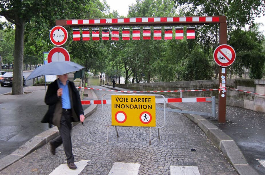
To reduce vulnerability, we can either avoid building sensitive infrastructure (hospitals, schools, etc.) on the flood plains of rivers, protect the affected zones (using dykes), or warn populations with sufficient notice.
To act in time, we need both hydrological forecasting (with predictive models) and appropriate organization, as demonstrated by the Sequana exercise that was held in Paris on March 7-18, 2016.
Should we be concerned about potential major flooding episodes?
That year, weather conditions led to significant rises in water levels in the Loing valley and in small Ile-de-France waterways (the Yvette), and slightly smaller rises in the Yonne and the Brie rivers (the Grand and Petit Morin, and the Yerres). The upper basins of the Seine and Aube were less affected. There was therefore only one basin contributing to the rising water levels in Paris in 2016, so it was unlikely that that the city would see similar scenario to that of the great flood of 1910.
An exceptional month of May?
While the timing is unusual, the situation in 2016 was not completely unexpected. Historically, the Seine in Paris has flooded in winter (in January 1910, 1924 and 1955, and in February 1945). However, this does not necessarily have to be the case. Other bodies of water, also subject to oceanic conditions, have seen major floods in the spring, as the Loire did in June 1856. In May 2013, a fairly similar (although more localised) event also affected the Yonne basin.
Although Paris broke the rainfall record for May in 2016 (176mm, up from the previous record – 132mm – in 1992), it should be remembered that May is generally a rainy month and, generally the rainiest month of the year in Paris.
Translated from the French by Alice Heathwood for Fast for Word.