
You can read this article in Welsh.
In British weather history, one storm stands out as a catalyst for change – the Royal Charter Storm of 1859. This devastating tempest off the west coast of Britain played a pivotal role in the founding of the shipping forecast and has had an enduring impact on weather forecasting in the UK and beyond.
Winds gusted at 100 miles per hour between October 25 and 26 that year – higher than any previously recorded in the Mersey, in north-west England. And it’s considered to be the most severe Irish Sea storm of the 19th century. More than 800 lives were lost and the storm sank or badly damaged more than 200 ships. But it also paved the way for the creation of the shipping forecast.
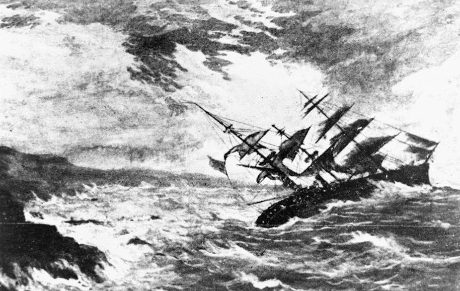
The storm is named after the most famous of the ships lost to the waves, a steam and sailing ship called the Royal Charter. After a two-month journey from Melbourne in Australia, the Royal Charter was heading towards Liverpool with its valuable cargo of gold. The ship was caught in the full fury of the storm off the coast of Anglesey, Wales.
Despite the crew’s valiant efforts to anchor the ship and cut its sails, the Royal Charter was driven onto the rocks in the early hours of October 26. With the help of villagers onshore, they succeeded in saving around 40 passengers. Other passengers had tried to swim to shore but were weighed down by the gold in their pockets and drowned. The ship eventually split in two and the waves claimed the lives of more than 450 passengers and crew members, including all the women and children aboard.
The tragic loss of life and property made the storm headline news. It even came to the attention of Charles Dickens, who was working as a journalist in London at the time and visited the site of the wreck soon after the storm.
The shipping forecast and the Met Office
Weather observations had been collected from around the British coast since 1854 by a part of the UK Met Office known then as the Meteorological Department of the Board of Trade. The Royal Charter Storm, however, highlighted a need for more accurate weather forecasting and a national storm warning system.

Vice Admiral Robert Fitzroy, founder of the Met Office, had been lobbying for the creation of such a storm warning system since the summer of 1859. Following the Royal Charter storm, Fitzroy was able to demonstrate that it could have been predicted.
In December of that year, the new storm warning system was approved and the first warning was issued in February 1861. This was delivered by telegraph to harbour towns, who then hoisted cones and drums on a mast to warn vessels in harbours and along the coast of the incoming storm.
The UK’s storm warning service – which later became known as the shipping forecast – is the longest running national forecasting service in the world. Today, the Met Office provides the shipping forecast on behalf of the Maritime and Coastguard Agency, and issues a forecast four times a day for the 31 areas of sea around the British Isles.
A lasting legacy
In addition to its meteorological legacy, the effects of the storm can still be seen around the Welsh coastline to this day. On Anglesey, the graves of those who died in the wreck can be found in many churches along the coast. Gold nuggets have also washed ashore in recent years.
Further south, in Cwmyreglwys, Pembrokeshire, stand the remains of Saint Brynach’s church, which was partially destroyed by the storm.

Since 1859, the Met Office has made significant strides in the field of meteorology. In August 1861, the first public weather forecast was printed in The Times, then broadcast on the radio in 1922 and was eventually seen on television for the first time in 1936.
Step by step, the Met Office has pioneered new technologies by launching the world’s first meteorological satellite in 1960 and using the first forecast by a computer in 1965. It has continued to invest in state-of-the-art supercomputers to improve severe weather and climate forecasting since then.
Today, the Met Office is a globally recognised authority in meteorology and climate science. Its expertise is invaluable for numerous sectors, from aviation and agriculture to emergency services and infrastructure planning. The Met Office is now responsible for providing the National Severe Weather Warning Service, which includes warnings for wind, rain, thunderstorms, lightning, ice, fog, snow and extreme heat.
Through the Met Office’s dedication to scientific research and accurate forecasting, the UK and the world have benefited from improved weather predictions and increased preparedness for extreme weather events. The legacy of the Royal Charter Storm lives on in the Met Office’s ongoing mission to provide essential weather and climate services, safeguarding lives and livelihoods in an ever-changing climate.