


As Midwest states struggled with record spring flooding this year, the Southwest was wrestling with the opposite problem: not enough water. On May 20, 2019, federal officials and leaders from seven states signed the Colorado River Drought Contingency Plan, a sweeping new water management agreement for this arid region.
The plan is historic: It acknowledges that southwestern states need to make deep water use reductions – including a large share from agriculture, which uses over 70% of the supply – to prevent Colorado River reservoirs from declining to critically low levels.
But it also has serious shortcomings. It runs for less than a decade, through 2026. And its name – “Drought Contingency Plan” – suggests a response to a temporary problem.
As scholars who have spent years researching water issues in the West, we know the Colorado River’s problems are anything but temporary. Its waters have already been over-allocated, based on a century of false optimism about available supply. In other words, states have been allowed to take out more than nature puts back in.
Now the river is being further depleted by climate change-driven aridification. The next steps, post-2026, require a recognition that Arizona, Nevada and California will likely have to come to terms with permanent reductions in their Colorado River supply. For their part, Wyoming, Utah, Colorado and New Mexico must abandon dreams of taking ever-larger gulps from the Colorado River to support future growth.
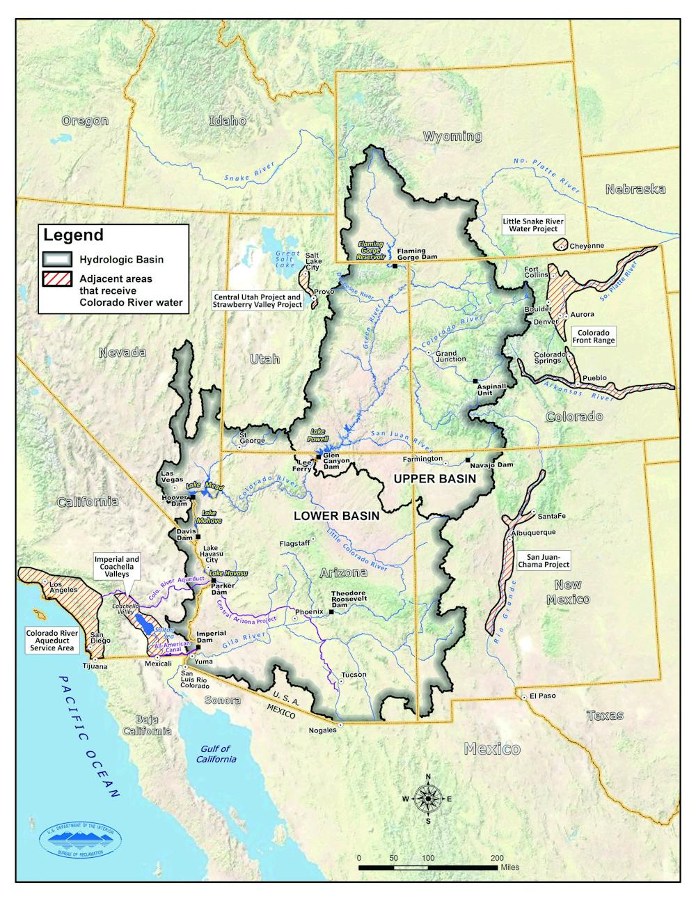
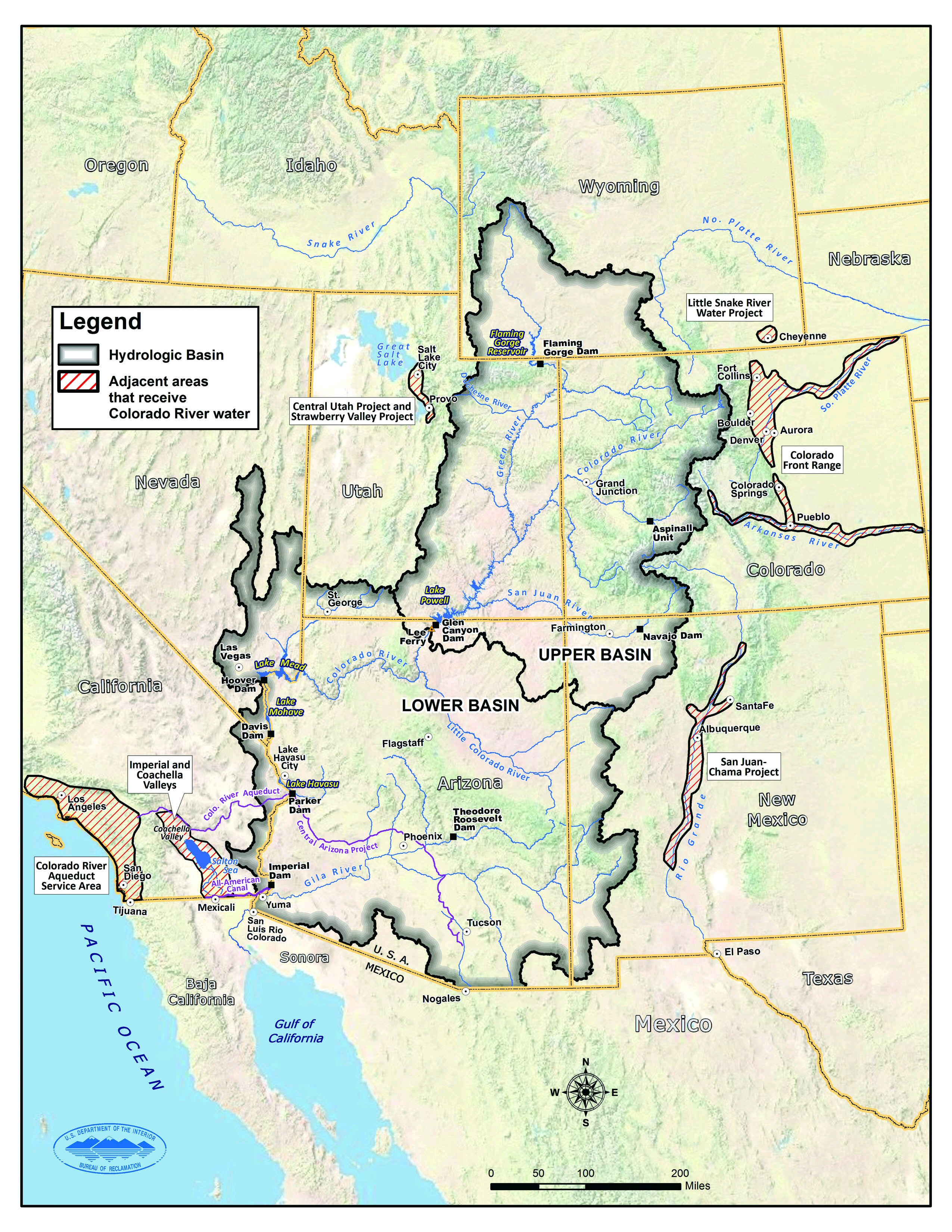
Draining western reservoirs
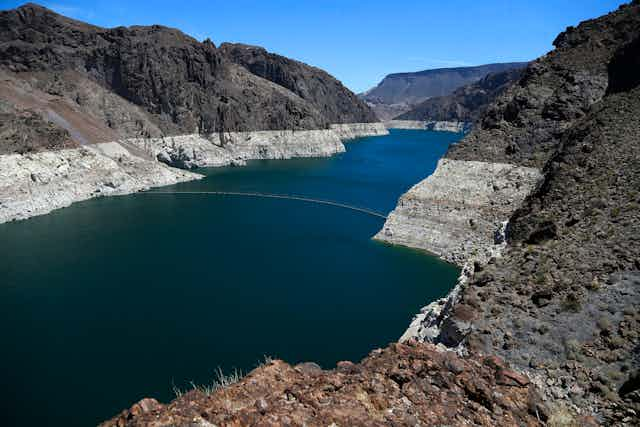
The Drought Contingency Plan is an important step in that direction. By creating a new layer of rules that temporarily reduces water allocations, it significantly reduces the chance of emptying Lake Mead, the massive reservoir on the Arizona-Nevada border that supports residents of Arizona, Nevada, California and Mexico. Without the plan, the lake conceivably could have been sucked dry – a devastating prospect for 40 million people who live in the Colorado River Basin.
As a seven-year stopgap, the plan comes just in time. After 19 years of unprecedented low flows, the nation’s two largest reservoirs – Lakes Mead and Powell – collectively contain only 40% as much water as they held in 2000. And while the winter of 2018-2019 was a big snow year, it merely balances the previous year, when record-setting warm and dry weather in large parts of the basin lowered water levels in Lake Powell by over 40 feet.
Dry years like 2018 are the far more likely future. From 2000 through 2004, annual runoff totaled only 65% of the 20th-century average. And in 2012-2013, it was just 60% of the 20th century average. More episodes like these would seriously compromise the system’s ability to provide water to the seven Colorado River Basin states and Mexico.
A hotter, drier future
Climate change is and will remain a significant issue. Since 2000, Colorado river flows have been 16% below the 20th-century average. Temperatures across the Colorado River Basin are now over 2 degrees Fahrenheit warmer than the 20th-century average, and are certain to continue rising.
Scientists have begun using the term “aridification” to describe the hotter, drier climate in the basin, rather than “drought,” which implies a temporary condition.
Studies show that higher 21st-century temperatures have been reducing runoff. Warmer temperatures increase evaporation from soils and water bodies, and increase sublimation from snowpacks – direct conversion of snow and ice into fog or steam, without melting first. And they increase plant water use, due to a longer growing season and more warmth on any given day.
In a 2017 study, one of us (Brad Udall) and Jonathan Overpeck found that higher temperatures due to climate change had reduced the flow of the Colorado River by approximately 6%. The study projected that additional warming could reduce flows by approximately 20% in 2050 and up to 35% by 2100 if precipitation levels did not change. A 2018 modeling study estimated the flow losses due to higher temperatures at about 10%.
Overuse in the Lower Basin states of Arizona, Nevada and California is the second major problem. This problem is officially known as the “Structural Deficit” – a 1.2 million acre-foot gap, representing 8% of the river’s flow, between allocations made in the early 20th century and the amount of water the river can provide.
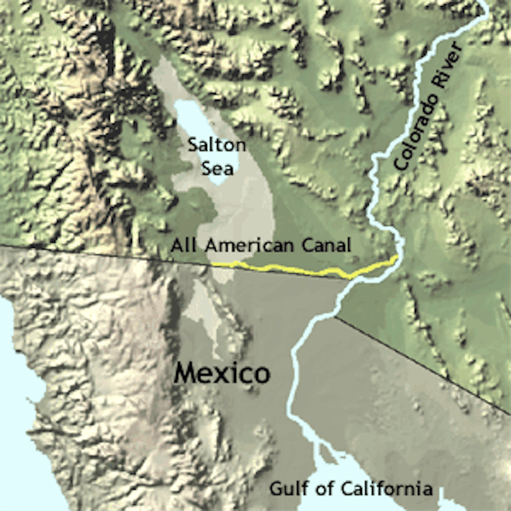
Cities from Las Vegas on the north to Tucson and Phoenix on the south and west to San Diego and Los Angeles all have come to depend on that water. Meanwhile, agriculture – including important areas like Yuma and the Imperial Valley, where much of the nation’s valuable winter produce is grown – uses 70% of the river’s water.
Looking past 2026
With the contingency plan only running until 2026, Basin leaders are already discussing the framework of a new planning effort. In our view, the process should be open and inclusive, given the huge number of competing interests in the region, including municipalities, agriculture, tribes and the environment.
An effective long-term plan should solve the overuse problem in the Lower Basin, while preparing for extended and unprecedented low flows. It should revisit a number of long-standing assumptions about how the river is managed, including the Upper Basin’s so-called “delivery obligation” to the Lower Basin, which leaves the upper states – Wyoming, Utah, Colorado and New Mexico - bearing the burden of climate change, while the Lower Basin states remain free to overuse. And it will have to address the reality that there is not enough water for users in the Upper Basin to continue exporting ever more water to growing cities like St. George, Utah, and Colorado’s Front Range.
Solving the twin problems of climate change and overuse will not be easy. The good news is that water users in the basin have found ways to work together for everyone’s benefit, first in a set of water management guidelines negotiated in 2007, and then with the Drought Contingency Plan.
Now, after staving off worry that system reservoirs could drop to calamitous levels, water users and managers can focus on these pressing longer-term issues. It is time to step back, look at the big picture and design a water management system that works for all stakeholders in the basin for the next several decades.
This study has been updated with a more detailed map of the Colorado River Basin.