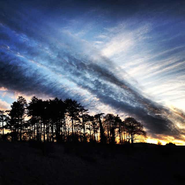

On several occasions this summer, Europe’s weather seemed to get itself stuck, leading to prolonged heatwaves and floods. In the UK, a long hot and dry spell throughout May and June gave way to a similarly persistent cool and wet period.
In September, Europe saw widespread flooding in southern Europe while the UK basked in its longest ever September heatwave. These were all the result of “blocked” weather patterns.
So what is blocking – and are events like this here to stay?
A blocking event is a disruption to the usual weather patterns of Earth’s middle latitudes. The normal state for Europe’s climate is to be led by the Atlantic, with weather systems forming over the ocean and sweeping eastward. Individual systems might bring sun or rain but in either case they are transient – here today and gone tomorrow.
This movement is closely linked to the jet stream: a fast-moving current of air which encircles the globe. This not only steers the weather systems but also drives the prevailing westerly winds that help keep Europe relatively cool in summer and mild in winter.
But when a block occurs, this prevailing maritime influence is lost. Blocking events are often responsible for the hottest days of summer but also the coldest days of winter.
Weather systems effectively ride the jet stream and distort it as they go. On weather maps we see this as a meandering of the jet, veering alternately north and south as it snakes its way east.
During blocking events, these meanders get larger until eventually the jet breaks up into swirling eddies. With the jet stream disrupted, weather patterns stick around, often for a week or longer. Some places get scorched while others are inundated, day after day.
Take the recent block, for example. The jet snaked south, then north, then south again, tracing out a giant Greek letter omega (Ω) over Europe. At the centre of the pattern was a large northward meander of the jet which kept warm air from further south stationary over France and the UK, gifting the latter seven days of 30°C heat.
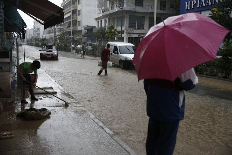
Flanking this on either side were southward meanders of colder air, which helped to anchor intense stationary cyclones. This resulted in huge amounts of rain falling across the Mediterranean, and hence floods: in Spain on one side of the omega, and in Greece and Libya on the other.
The latter were particularly affected as Storm Daniel, in the eastern part of the omega, intensified and developed signs of a “medicane”, or Mediterranean hurricane.

Blocking occurs once or twice every season, on average. But rising temperatures due to climate change have yielded more intense heatwaves in the warm parts of the block.
Since warmer air holds more moisture, rainfall is also usually more intense. If Europe had had exactly the same omega pattern 50 years ago, many of the impacts would have been weaker.
Are blocking events getting more common?
Some meteorologists argue that the jet stream is getting weaker and more prone to disruptions such as this. However, the trends are inconclusive and so these remain theories.
The fact that scientists disagree on this issue highlights how uncertain some of the effects of climate change still are. Humankind is clearly messing with a highly complex system that we do not fully understand.
Climate models indicate that blocking might become rarer as the world warms and the jet stream shifts a little further north, on average. But this is still unclear and if it does happen, it’s likely to be a pretty small change.
Blocking isn’t going away any time soon and many impacts, such as heatwaves and flooding, are only likely to get worse with higher air temperatures. In fact, it’s quite likely that more severe events than those of this summer could strike in today’s climate.
Since blocking is relatively rare and sporadic, scientists don’t have a good sample of events on which to base their estimates of risk. It’s certainly possible that the blocks this summer could have lasted even longer than they did, or struck at a worse time.
Had they occurred at the peak of the annual cycle, rather than the start and end of the summer as they did, the heat would have been more intense. The UK’s first 40°C temperature was observed in July 2022 during a mercifully short heatwave. A persistent block at that time of year would be fierce.
And the jet stream itself adds another twist to the tale. The jet has tended to shift south over Europe in summers since 2000, in a pattern that favours relatively cool and wet conditions in north-west Europe. This appears to be a feature of natural variations in Earth’s climate, at least in part, but our understanding of this remains poor.
If or when the jet shifts back north, it would bring higher average summer temperatures as well as the risk of blocking-induced heatwaves. We had an early taste of this combination in 2018, the UK’s warmest summer on record. European summer heat has been getting worse due to climate change, but we should be preparing for even worse in the near future.

Don’t have time to read about climate change as much as you’d like?
Get a weekly roundup in your inbox instead. Every Wednesday, The Conversation’s environment editor writes Imagine, a short email that goes a little deeper into just one climate issue. Join the 20,000+ readers who’ve subscribed so far.