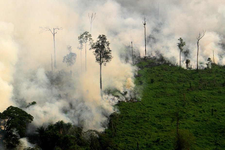
In 1997-98, extremely dry El Niño conditions in Indonesia kicked off a wave of large–scale uncontrolled burning, destroying about five million hectares of tropical forest (equivalent to seven million football fields). Much of the burning occurred in carbon-rich peatland forests and continued in two phases from July 1997 until March 1998, releasing vast amounts of carbon dioxide into the atmosphere, and huge clouds of smoke and haze across the region.
Present conditions in the Pacific Ocean are similar to what they were in mid-1997. El Niño is set to strengthen, and seasonal weather prediction models point towards this being an exceptionally dry season. Indonesia and its neighbours should be worried.
In order to predict, and hopefully prevent, such fires in the future, we’ve looked at how far in advance they can be anticipated using a seasonal weather prediction model.
Deforestation, peat drainage and El Niño
During the dry season, numerous fires occur in Indonesia’s peatland forests, particularly in the southern region of Kalimantan and eastern Sumatra. Although some rain falls during a normal dry season, it is sporadic, leaving many windows of opportunity for burning.
Most of these fires are deliberately lit to clear rainforest to establish oil palm and Acacia pulp and paper plantations. Fire spread is enhanced by the increased availability of combustible material, notably, woody debris as a result of wasteful logging practices, and the widespread practice of draining peatlands.
When El Niño strikes, however, the situation changes drastically. During strong El Niño episodes, almost no rain falls during the dry season and the monsoon is delayed. So in areas where peatlands have been degraded by logging and draining, fires ignite easily and once started, the peat is so dry that fires escape underground, and cannot be put out until after the monsoon reappears.
At their worst, the fires have enormous impacts on carbon emissions, regional haze production, biodiversity, and the economy, and are recognised as a serious health risk in Indonesia as well as neighbouring Singapore and Malaysia. The fires are a major threat to the remaining orangutans who live in the forests – the Bornean orangutan is rated endangered, and the Sumatran orangutan is critically endangered. During past El Niño years, around one gigatonne of carbon was emitted from peatland forest fires, equivalent to about 10% of annual global fossil fuel emissions, and regional haze from such fires has caused major disruptions to air traffic in nearby Singapore and Kuala Lumpur.

Sea surface temperatures from the vast array of sea buoys established across the Pacific Ocean plus other important meteorological data are now telling us that El Niño conditions are already in place. Furthermore, most seasonal weather prediction models, which are driven by observed SSTs, predict El Niño will strengthen over the coming months. This means the upcoming dry season in Indonesia will probably be much drier than usual, and the fires worse.


Early warning systems
The regional haze problem has become so serious in recent years that the Singapore government passed the Trans-boundary Haze Pollution Act in 2014. This act financially penalises companies listed on the Singapore stock exchange deemed responsible for smoke-haze affecting the city-state but originating elsewhere. The governments of the ten ASEAN member states signed the ASEAN Agreement on Trans-boundary Haze Pollution on 10 June 2002, which Indonesia finally ratified in September 2014.

The agreement requires all states to implement measures to prevent, monitor and mitigate trans-boundary haze pollution by controlling peat land and forest fires. It makes explicit mention of the development of an early fire warning system to help prevent and mitigate major haze events.
Since burning is opportunistic, it can happen as soon as conditions will allow it. Research since the 1997 haze disaster has given us a fairly reliable understanding of how dry conditions must be in order for severe fires to happen.
But by the time these conditions occur, burning has already started, fires have escaped, and it is too late for prevention. Dry conditions instead need to be forecast weeks to months in advance for any prevention to be effective. Up until now, the forecasting component has been missing.
We wanted to see if past fires, especially severe El Niño-influenced fires, could have been predicted using seasonal weather forecasts. Using satellite observations of fire activity and the case study region of southern-central Kalimantan, which is characterised by a June-November dry season, we demonstrated that most of the severe fires (and associated haze) since 1997 could have been anticipated using rainfall predictions from the European Centre for Medium-Range Weather Forecasts seasonal weather prediction model. A second part of our work confirmed a clear link between severe fires and massive forest loss (also estimated from satellite data).
Our findings were recently published in the journal Natural Hazards and Earth System Science.
The implication of our work is that regional weather services, fire-fighting and resource management agencies are potentially able to identify areas that are likely to be dangerously dry ahead of time. Preventing severe uncontrolled burning in Indonesia and associated impacts will ultimately depend on how well fire is managed. This is a complex problem involving governments, multinational companies and indigenous people. Nonetheless, knowing ahead of time about a potentially bad fire situation will no doubt form part of the final answer.
While seasonal predictions are not perfect, and occasionally a year may turn out differently to what was expected, seasonal forecasts are anticipated to continue to show improved skill in future. The challenge remains to build on these advances to create an Indonesia-wide early fire warning system for operational use.

