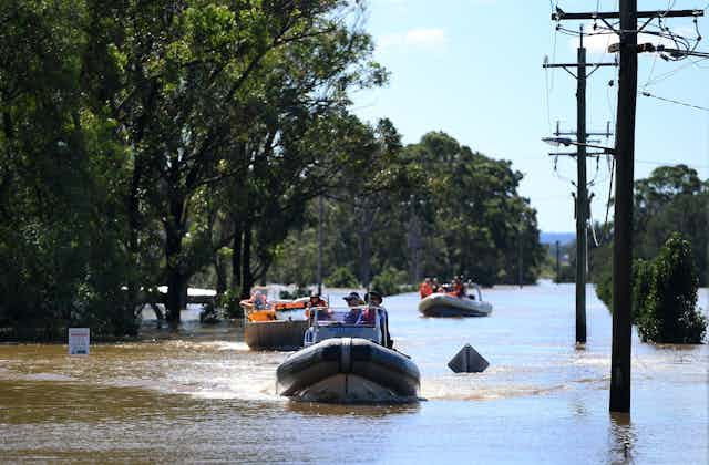

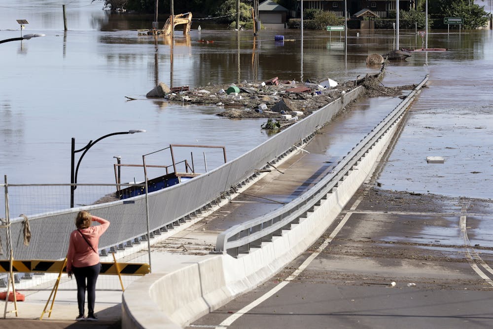
Last month’s flood in the Hawkesbury-Nepean River region of western Sydney peaked at a staggering 12.9 metres, with water engulfing road signs and reaching the tops of many houses.
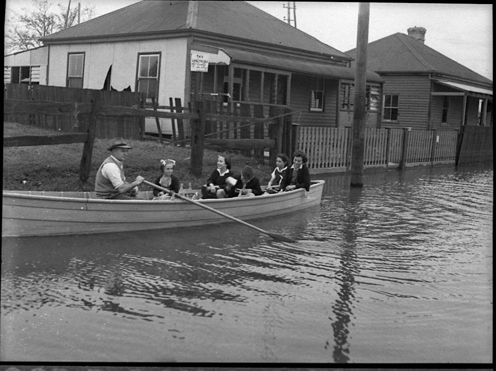
There hasn’t been a major flood on the Hawkesbury-Nepean for more than 30 years, with the last comparable one occurring in 1990. Long-term Sydneysiders, however, will remember that 12 major floods occurred during the 40 years before 1990. Five of these were larger than last month’s flood.
So what’s going on? The long-term rainfall pattern in the region and corresponding river flow is cyclic in nature. This means 40 to 50 years of dry weather with infrequent small floods are followed by 40 to 50 years of wet weather with frequent major floods.
As river and floodplain residents take stock of the recent damage to their homes and plan necessary repairs, it’s vital they recognise more floods are on the way. Large, frequent floods can be expected to occur again within 10 or 20 years if — as expected — the historical pattern of rainfall and flooding repeats itself.
Living in a bathtub
Many of the 18,000 people who were evacuated live in and around a region known as the “Sackville Bathtub”. As the name suggests, this flat, low-lying section of the floodplain region was spectacularly affected.

The Sackville Bathtub is located between Richmond and Sackville. It’s part of the Cumberland Plain area of Western Sydney and formed very slowly over 100 million years due to plate tectonic processes. The bathtub’s mudstone rock layers are folded into a broad, shallow, basin-shaped depression, which is surrounded by steep terrain.
Downstream of Sackville, the Hawkesbury-Nepean River flows through sandstone gorges and narrows in width. This creates a pinch-point that partially blocks the river channel.
Just as a bath plug sitting half-way over a plughole slows an emptying bath, the Sackville pinch-point causes the bathtub to fill during floods.
Will raising the dam wall work?
The NSW state government is planning to raise the wall of the Warragamba Dam to help mitigate catastrophic floods in the region. But this may not be an effective solution.
Typically, somewhere between 40% and 60% of the floodwater that fills up the Sackville Bathtub comes from unimpeded, non-Warragamba sources. So, when the Hawkesbury-Nepean River floods, the bathtub is already quite full and causing significant problems before Warragamba begins to spill. The Warragamba water then raises the flood level, but often by only a couple of metres.
Raising Warragamba Dam’s wall as a mitigation measure will only control about half the floodwater, and won’t prevent major floods delivered by the Nepean and Grose rivers, which also feed into the region. This represents a small potential benefit for a very large cost.

A long flooding period is on our doorstep
The idea of drought-dominated and flood-dominated periods for the Hawkesbury-Nepean River system was proposed in the mid-1970s by the University of Sydney’s Robin Warner. Since the late 1990’s, it hasn’t been the focus of much research.
Read more: What is a 1 in 100 year weather event? And why do they keep happening so often?
He showed a century-long cycle of alternating periods of dry weather and small floods followed by wet weather and big floods is normal for Sydney. This means the March flood may not have come as a surprise to older residents of the Sackville Bathtub, who have a lived experience of the whole 40-50 year flooding cycle.
As a rough average, one major flood occurred every four years during the last wet-weather period between 1950 and 1990. The largest of this period occurred in November 1961. It filled the Sackville Bathtub to a depth of 15 metres and — like the June 1964 (14.6 metres) and March 1978 (14.5 metres) events — caused more widespread flooding than this year’s flood.
We’re currently 30 years into a dry period, which may be about to end. Conditions might stay dry for another 10 or 20 years.
These cycles are likely caused by natural, long-term “climate drivers” — long-term climatic fluctuations such as El Niño and La Niña, the Pacific Decadal Oscillation and the Indian Ocean Dipole, which are driven by oceanic current circulations. These global phenomena bring both benevolent weather and destructive weather to Australia.
Eastern Australia experiences decades-long periods of wetter weather when these climate drivers sync up with each other. When they’re out of sync, we get dry weather periods.
These long-term cycles are natural and have been operating for thousands of years, but climate change is amplifying and accelerating them. Dry periods are getting drier, wet periods are getting wetter.
The good news and bad news
The bad news is that 12-plus metre floods at Hawkesbury River (Windsor Bridge) are not all that unusual. There have been 24, 12-plus metre floods at Windsor Bridge since 1799.
The good news is meteorological forecasters are excellent at predicting when the storms that generate moderate, large and catastrophic floods are coming. We can expect several days’ to a week’s notice of the next big flood.
We can also prepare our individual and communal responses for more large and frequent floods on the Hawkesbury-Nepean. Residents of the area need to think about how they might live near the river as individuals. Decide what is precious and what you will fit into a car and trailer. Practice evacuating.
As a community, we must ensure the transport infrastructure and evacuation protocols minimise disruption to river and floodplain residents while maximising their safety. It’s particularly important we set up inclusive infrastructure to ensure disadvantaged people, who are disproportionately affected by disasters, also have a fighting chance to evacuate and survive.
Read more: Not 'if', but 'when': city planners need to design for flooding. These examples show the way
Upgrading the escape routes that enable people to evacuate efficiently is absolutely vital. As is rethinking whether we should continue urban expansion in the Sackville Bathtub.
So remember, the next major flood is going to occur sooner than we would like. If you live in this region, you must start preparing. Or as a wise elder once said, “Live on a floodplain, own a boat!”
This story is part of a series The Conversation is running on the nexus between disaster, disadvantage and resilience. It is supported by a philanthropic grant from the Paul Ramsay foundation. Read the rest of the stories here.