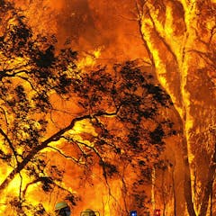
An analysis of 88 million wildfire observations over the past 21 years shows a strong increase in the frequency and intensity of the most extreme fires around the world.
House of the Dragon features fire breathing dragons.
HBO
The 2023 megafires burnt more than 84 million hectares of desert and savannah in northern Australia. That’s larger than the whole of NSW, or more than three times size of the UK.
We compiled maps of bushfires and prescribed burns in southern Australia from 1980 to 2021 to see how fire activity is changing habitat for 129 threatened species such as mountain pygmy possums.
Marsupial rescue, rehabilitation and release statistics from New South Wales and Kangaroo Island during Black Summer fires reveal poor survival rates, despite the courageous efforts of volunteers.
Ulladulla Local Aboriginal Land Council and Mane Collective
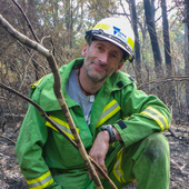
What does fire management do to soils? We compared prescribed burning to cultural burning and looked at how soil properties changed after fire. Cultural burning was better.
Why do batteries lose charge more quickly when it’s cold?
Halfpoint Images/Moment
We’re all familiar with fire. But do you really know what it is and how it starts? Here’s the chemistry of fire – and why Australia is so prone to going up in flames.
Fire is a social equality issue. Amid fresh concerns over rogue landlords and dangerous overcrowding, why have calls for change gone unheeded for so long?
Humans have been making fire by friction for centuries, but it’s not easy.
Cyndi Monaghan/Moment via Getty Images
We used satellite data to create global maps of where and how fires are burning. Fire season lasts two weeks longer than it used to and fires are more intense. But there are regional differences.
South African police officers at the scene of the burned building in Johannesburg.
Luca Sola/AFP via Getty Images
Inner city occupations and shack settlements alike are the inevitable consequence of the fact that huge populations of people have to get by without a living wage.
Homeowners and local governments can take steps to help protect homes from fires.
AP Photo/Keith D. Cullom
Adapting to our fiery future means preparing for the risks and not putting out every low-risk wildfire, writes the author of a new book on learning to live with fire.
Identifying victims after a disaster can offer closure to loved ones.
AP Photo/Jae C. Hong
Maui officials have asked relatives to provide DNA samples to help identify victims of the Lahaina wildfires. Time and exposure to the elements, however, can make DNA retrieval from remains difficult.