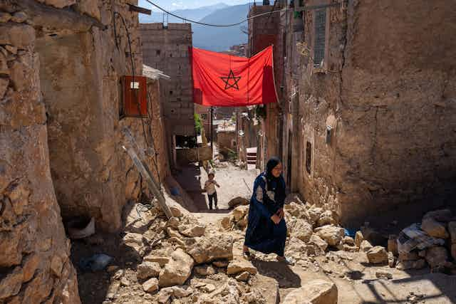

The epicentre of Morocco’s devastating earthquake on 8 September was in the High Atlas Mountains, about 71km south-west of Marrakesh. Moina Spooner, from The Conversation Africa, asked Jesús Galindo-Zaldivar, who has been carrying out research on the formation of the Atlas mountains and the geology of the area, about the factors which led to this situation.
What research have you been doing in Morocco’s Atlas Mountains?
The Atlas Mountains are a fascinating range in north-west Africa, spanning Morocco, Algeria and Tunisia. They’re situated south of the main Eurasia and Africa (Nubia) tectonic plate boundary.
This area doesn’t usually have a lot of earthquakes compared to other places near the edges of tectonic plates, where the movements of plates will cause intense seismic activity. But in 1960 the Agadir earthquake caused a lot of damage and loss of life.
I’m part of a team of geologists, geophysicists and geodesists from various Moroccan universities and Spanish institutions carrying out research in the area. We want to understand this mountain range’s development and its position at the edge of a continental plate boundary. Studies of seismic activity, gravity and other geophysical phenomena allow us to understand the Earth’s deep structure, down to depths exceeding 100km.
Through field geological research, we can detect and analyse faults – fractures or cracks in the Earth’s crust along which there has been movement. These movements can be horizontal, vertical or diagonal, and they occur due to the immense forces acting on the Earth’s tectonic plates.
Finally, using geodetic techniques (GPS recordings) we are able to determine how tectonic plates are moving. This is done by regularly measuring benchmark sites with millimetre accuracy.
What has your research found?
Our research shows that the Atlas Mountains were formed during the break-up of the Pangea supercontinent. It is now a mountain range that is actively rising, as evidenced by its high peaks and steep slopes.
The steep slopes of the mountains and the straight lines where the Earth’s crust has cracked suggest that there has been recent movement in the Earth beneath this area. It’s surprising that there aren’t more earthquakes here.
The Atlas Mountains are getting pushed together at a rate of about 1 millimetre each year. This happens because the Eurasian and African plates are moving closer to each other. This squeezing action is responsible for creating the tallest mountains in the area, the southern edge of where these two big plates meet.
What do your findings tell you about this earthquake?
The catastrophic earthquake took place to the north of the western Atlas mountains, south of Marrakesh. According to estimates by Morocco’s National Institute of Geophysics and the US geological survey, the depth is between 8km and 26km.
The earthquake resulted from a geological phenomenon called a “reverse fault”. This occurs when tectonic plates collide, causing the Earth’s crust to thicken. The stress along these fault lines can induce earthquakes as rocks abruptly shift to release accumulated stress, which is characteristic of a seismic fault.
The 6.8 magnitude implies that the fault responsible for this earthquake is probably around 30km long. This estimate takes into account the relationships between active fault length and earthquake magnitudes.
So, why don’t we see many earthquakes in this area, even though it’s a place where the tectonic blocks are moving and the mountains are rising? Earthquakes happen when there’s a sudden shift in rocks along a fault line, caused by the release of stored energy that’s been building up over time. In this region, there haven’t been any major recorded earthquakes before, which suggests that the stress from the plates pushing together has been building up deep underground for a long time. When the stress got too much for the fault to handle, it caused an earthquake.
In this mountain belt faults might not produce earthquakes very often. After the earthquake, the rocks in the area moved and adjusted, but other nearby faults might now be under extra stress, and they could produce smaller earthquakes known as aftershocks that might continue for months or even years.
What should authorities be doing to prepare?
Earthquakes are difficult to predict and cannot be avoided. However, we can mitigate their impact. Through integrated studies of the region’s geology, geophysics and geodesy we can find out where there are active earthquake faults. We can also estimate how powerful the earthquakes on these faults could be and how often they might happen again. This helps us understand how strong future earthquakes in a specific area could be. Faults that don’t have earthquakes often but can still produce strong ones are a big concern. In the future, finding and studying these types of faults will be a focus of earthquake research.
The best way to minimise earthquake damage is to improve seismic building design codes to withstand the highest possible seismic activity. This will help buildings and other structures hold up better against strong shaking. In addition, it’s crucial that traditional homes and rock constructions in mountain villages be reinforced to prevent future disasters. New constructions must be tested and designed cheaply and efficiently, respecting new seismic building standards.