A heatwave across northern Australia comes as a shock to the system. The impacts of heat are worst in early summer when we’ve had less time to acclimatise, so it’s important to heed health warnings.
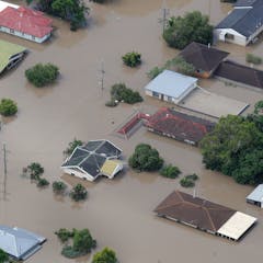
La Niña is officially here for the third year in a row. You probably associate it with flooding, but how might it affect future drought and bushfires? And could a fourth La Niña be possible?
By following moisture from the oceans to the land, researchers worked out exactly how three oceans conspire to deliver deluges of rain to eastern Australia.
Last week the Bureau of Meteorology declared a negative Indian Ocean Dipole — a natural climate phenomenon set to bring wet weather. Let’s look at what you can expect, and the role of climate change.
Future extremes from the Indian Ocean will be acting on top of global warming, giving a double whammy effect, like the record-breaking heat and drought we saw in 2019.
Joëlle Gergis, Australian National University and Geoff Cary, Australian National University
The latest bushfires cannot be compared to Ash Wednesday or Black Saturday. Our nation’s fire history is being rewritten.
Firefighters battle bushfires in Angourie, northern New South Wales, on September 10 this year, marking another early start to the season.
Jason O'Brien/AAP
Bureau of Meteorology researchers painstakingly analysed more than 40 years of data to work out exactly what is causing Australia’s spring bushfire phenomenon.
Maximum temperatures for January to September were the warmest on record for the Murray–Darling Basin and New South Wales.
DEAN LEWINS/AAP
Since 1999, Australia has swung between drought and deluge with surprising speed, because El Niño has fallen into sync with similar patterns in the Indian and Southern Oceans.