Indonesian fire fighters extinguish a fire in a land next to residence in Pekanbaru, Riau province on September 13, 2019. The blazes spread smog across Southeast Asia and adding to concerns about the impact on global warming.
Adek Berry/AFP
Wildfires are intensifying, yet they’re one of the most poorly understood phenomena on Earth. New research shows that they can disturb both regional and global climate.
Trees like these near Traverse City, Michigan, remove carbon dioxide from the air and lock it away.
Owen Weber/www.owenweberlive.com via Getty Images
With decades of images and data from the same locations, these satellites can show changes over time, including deforestation, changes in waterways and how loss of trees corresponds to urban heat.
After the 2018 wildfire in Paradise, Calif., many fire-damaged homes were razed.
Justin Sullivan/Getty Images
Managed retreat is already common in flood-prone areas, but what about in neighborhoods at high risk from wildfires? Here are four ways communities can pull back for safety.
A large tundra fire burned near St. Mary’s, Alaska, on June 13, 2022.
BLM Alaska Fire Service/Incident Management Team/John Kern
Tropical forest covers 12% of the planet’s land surface yet hosts around two thirds of all terrestrial species. Amazonia, which spans the vast Amazon River basin and the Guiana Shield in South America…
A child from the Mayuruna ethnic group stands on a pier on the banks of the Atalaia do Norte River in Amazonas state, Brazil, on June 12, 2022. Federal police and military forces are searching and investigating the disappearance of British journalist Dom Phillips and Indigenous affairs expert Bruno Araujo Pereira.
(AP Photo/Edmar Barros)
More carbon dioxide in the air doesn’t necessarily mean more growth for trees, and the increasing risk of wildfires and drought has major consequences, as an interactive map shows.
Changes in climate affect the timings of various points in the life cycle of plants, including when flowers bloom in spring and when leaves wither in autumn.
(Shutterstock)
Alana Chin, Swiss Federal Institute of Technology Zurich
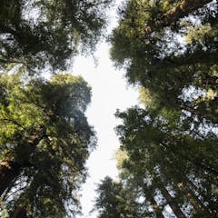
New research shows that coast redwood trees have a surprising adaptation that helps them thrive in both wet and dry environments.
An abandoned forest road that has become impassable due to the washout of the culvert fill. The beaver dam has also contributed to road erosion.
(Forest Hydrology Laboratory of Université Laval)
By mismanaging its forestry road system, Québec and the forestry companies operating in public forests have made significant savings, to the detriment of protecting aquatic environments.
Reforestation programmes should consider the parasitic relationship between mistletoes and their hosts and their ecological benefits for bird diversity.
Scientists have uncovered Roman farms beneath what was thought to be prehistoric forest in France.
The Berezinsky Reserve in Belarus is one of the few corners of the European portion of the southern taiga that is in pristine condition.
Denis Ivkovich/Unesco