Zhe Zhu, University of Connecticut y Su Ye, University of Connecticut
Artificial intelligence can spot differences in images from before and after a storm over wide areas in almost real time. It showed Hurricane Ian’s vast damage in Florida.
Maps contain useful information, but that means leaving out other information that is also useful.
Associated Press
The coronavirus pandemic has driven a lot of scientific progress in the past year. But just as some of the social changes are likely here to stay, so are some medical innovations.
An algorithm driven world is dehumanising – but by understanding this we can call for a more equitable and human use of data.
Tharp with an undersea map at her desk. Rolled sonar profiles of the ocean floor are on the shelf behind her.
Lamont-Doherty Earth Observatory and the estate of Marie Tharp
Born on July 30, 1920, geologist and cartographer Tharp changed scientific thinking about what lay at the bottom of the ocean – not a featureless flat, but rugged and varied terrain.
A mylar balloon at Presqu'ile Provincial Park in Ontario, Canada.
Lara O'Brien
Releasing balloons at weddings and other celebrations is festive, until they break into pieces and become plastic pollution. A citizen science project is spotlighting the problem.
NASA’s Worldview software gives you a satellite view of Earth right now, and can help track the spread of fires.
Nasa Worldview
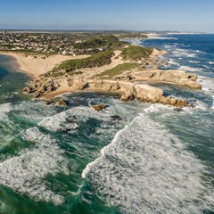
By understanding how bushfire maps are created, and what their features represent, you can get better at spotting fake ones.
A section of Beijing Daxing International Airport from the first 3D images released by China National Space Administration using data from the recently launched Gaofen-7 Earth observation satellite, which can resolve objects less than a metre wide.
China National Space Administration/Xinhua
China has embraced the concept of Digital Earth – the use of data from satellites to create a visual map of what’s happening at every point on the planet – and is now a key player in making it happen.
One nine-year-old chose his local supermarket as a place he valued because he could “spend time with mum and help decide what goes in our trolley”.
Shutterstock
When primary school children in a disadvantaged part of Sydney were asked to map what they valued in the area, their choices were revealing and sometimes surprising.
Where has your produce been?
CoolR/Shutterstock.com